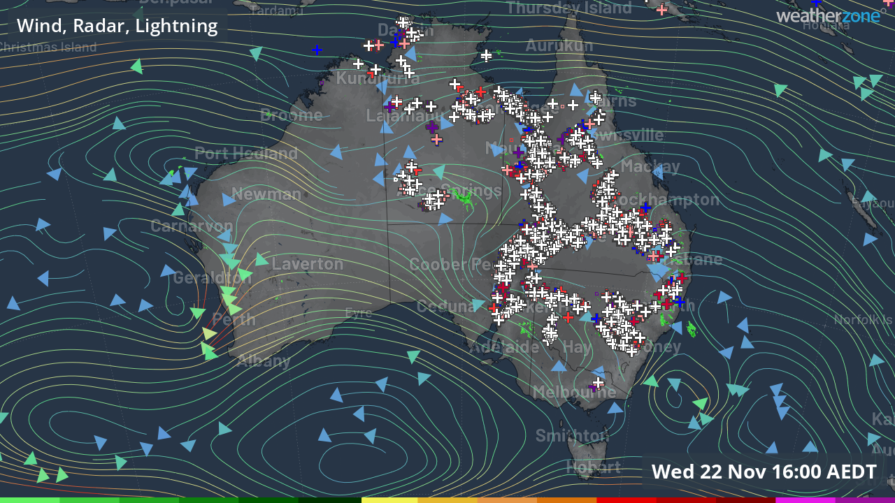
Australia is lit up like a Christmas tree
Just take a look at that 4 pm Wednesday national radar.
On a north-south axis, there are storms from Darwin all the way south to Port Augusta at the head of Spencer Gulf. On an east-west axis, there are storms from the Red Centre to the Sunshine Coast, while there are storms right across the interior of NSW and Qld.
The overall effect of so many storms is that the eastern half of Australia looks lit up like a Christmas tree on the radar image!

If you use your imagination, the silver crosses which we use to show lightning strikes look a little like tinsel, while the wind direction arrows could pass for baubles on the branches of the tree.
To extend the possibly painful analogy for just one more paragraph, the gifts underneath this afternoon's Christmas tree are of the precious wet variety, as in rain.
This week's widespread storms are being caused by a broad surface trough and are generally slow moving or even near-stationary. This means that some places are getting a good drenching while other nearby spots are missing out.
For example, to 9 am Wednesday, Bathurst received 34 mm and Bathurst Airport got 14.8 mm. No other location in the NSW Central Tablelands forecast district received more than 5 mm in the same 24-hour period.
In Queensland, Australia's so-called "peanut capital" of Kingaroy in the Wide Bay and Burnett forecast district, has received 33.4 mm to 4 pm Wednesday AEST, most of it in a short mid-afternoon downpour, while no other weather station in the region has recorded more than 2.2 mm.
The pattern of widespread storms should persist until at least Saturday for much of the country.