
Australia getting hammered by two jet streams
Two jet streams are currently clashing into each other above Australia and it is causing an unseasonable mix of dangerous weather in several states and territories.
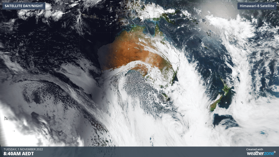
The sequence of satellite images below shows a huge mass of speckled cloud moving up from the Southern Ocean towards Australia on Tuesday morning. This specked cloud has formed in a large pool of cold air that has been dragged north from the fringes of Antarctica by a bend in the polar jet stream.
Jet streams are meandering bands of powerful upper-level winds that flow continuously around our planet at a height of about 8 to 15 km above sea level. There are two main jet streams and they both play an important role in transporting weather systems and air masses across our planet:
- The polar jet is located at around 50º to 60º latitude in the northern and southern hemispheres, forming a meandering ring around the north and south polar regions.
- The subtropical jet is positioned closer to the equator, at about 30º latitude in both hemispheres.
The image below shows where the strength and position of the two jet streams over the Australian region on Tuesday morning.
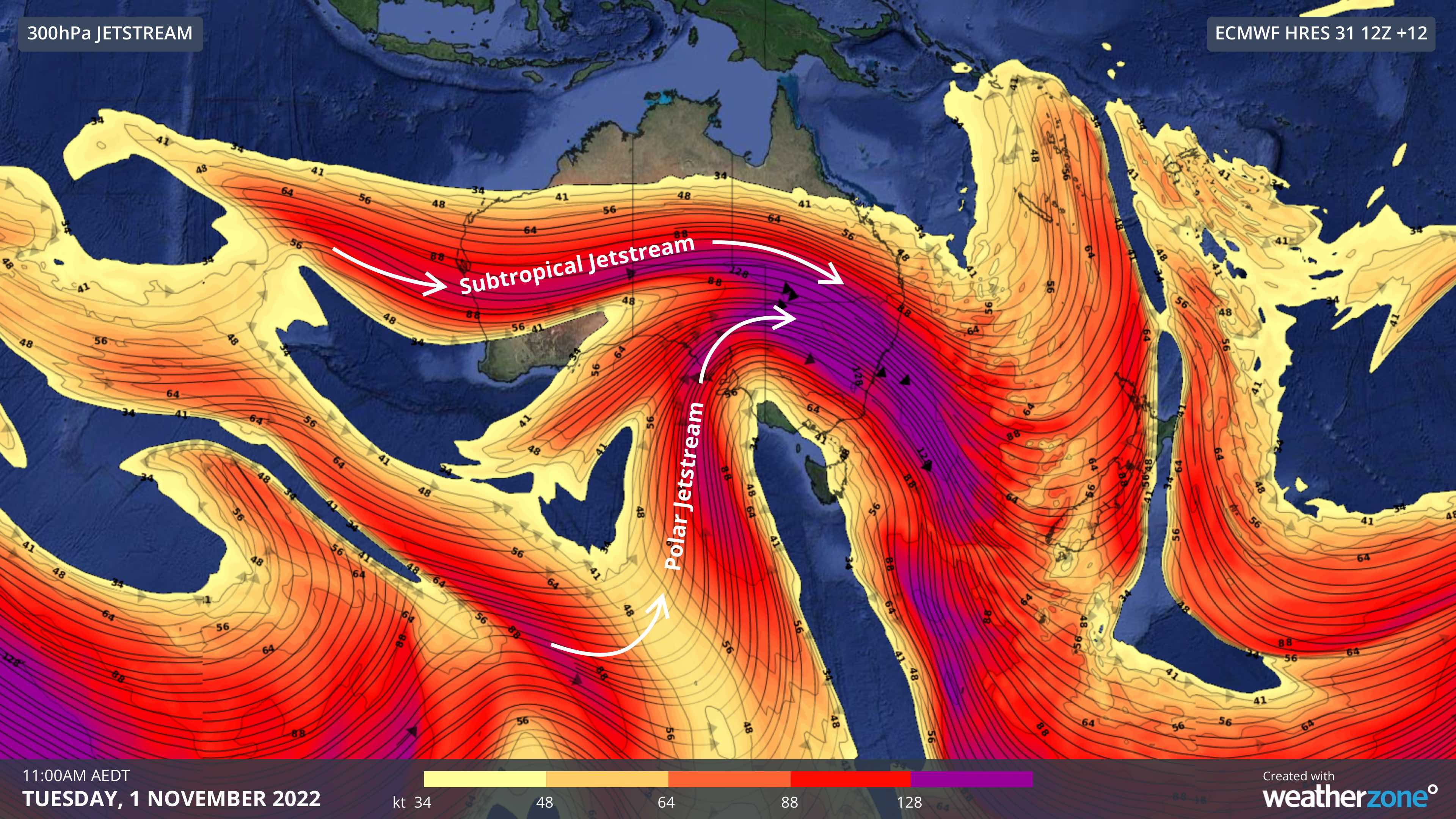
Image: Modelled 300hPa jet stream wind speed and direction at 10am AEDT on Tuesday, November 1, according to the ECMWF-HRES model.
The image above shows that a strong section of the subtropical jet is currently clashing with a bend in the polar jet over Australia. This setup is allowing very cold polar air to interact with much warmer air sitting over the Australian continent, creating a large contrast in temperature and air mass density that is producing a dangerous mix of weather. Here are some of the warnings that are in place today:
- Severe weather warnings have been issued for damaging winds in parts of Sa, Qld and NSW today
- Flood watches and flood warnings are in place across several states in southeastern and eastern Australia in response to heavy rain from this current system
- Sheep graziers' warnings have been issued in parts of Tas, Vic, NSW and Qld due to the combination of cold temperatures, showers and blustery westerly winds on Tuesday and Wednesday
- A bushwalker’s weather alert has been declared in parts of Tasmania, where out-of-season snow could reach down to about 600 metres elevation on Tuesday and Wednesday morning
- Severe to Extreme heatwave warnings have been issued in northern districts of QLD and the NT in response to a hot air mass that is being trapped over Australia’s tropics to the north of the subtropical jet stream
- Fire weather warnings have been declared in parts of WA and SA, where hot and dry air will combine with blustery winds to cause Extreme fire danger on Tuesday
Combining the satellite and jet stream layers on a map helps to showcase how the jet streams are shaping the weather over Australia today. The image below shows the polar jet pulling cold air and speckled clouds over southern Australia and the subtropical jet directing a thick rain-bearing cloud band over Qld.
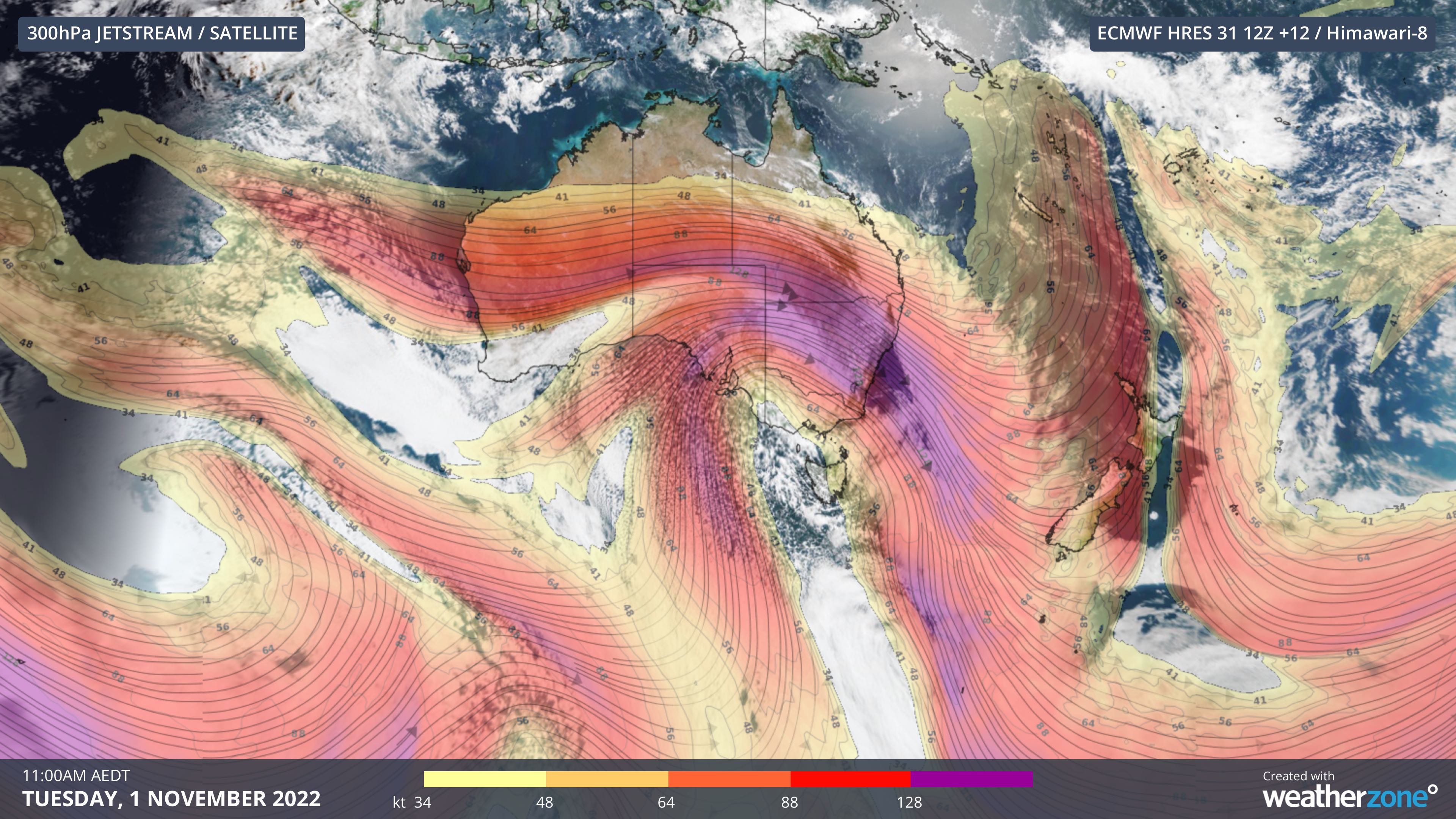
Image: Composite visible satellite and modelled jet stream winds at 10am AEDT on Tuesday, November 1, 2022.
Be sure to check the latest warnings for the most up-to-date information on this evolving weather event.