
Australia actually had powder snow this weekend
Snow in Australia often has a consistency like wet cement. Sometimes it’s so wet and heavy in marginal temperatures that are barely below freezing, they call it "elephant snot".
But on the weekend in Australia's ski resorts, temperatures were so cold in a relatively dry airmass that we saw light, fluffy, powdery snow of the type that draws Australians en masse to overseas destinations like Canada and Hokkaido.
Yes, powder. Ridgey-didge, fair dinkum Aussie powder just like they have overseas.
As the Victorian ski resort of Mt Hotham shivered through its equal-lowest July temperature in 34 years of records on Sunday morning (plummeting to -8.8°C which is cold for a mountain-top weather station), local photographer Chris Hocking took to the slopes to take photos like this.
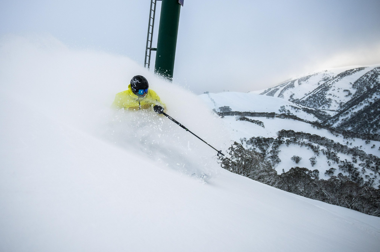
Image: Some days, Aussie snow is world class. Source: Chris Hocking.
And this.
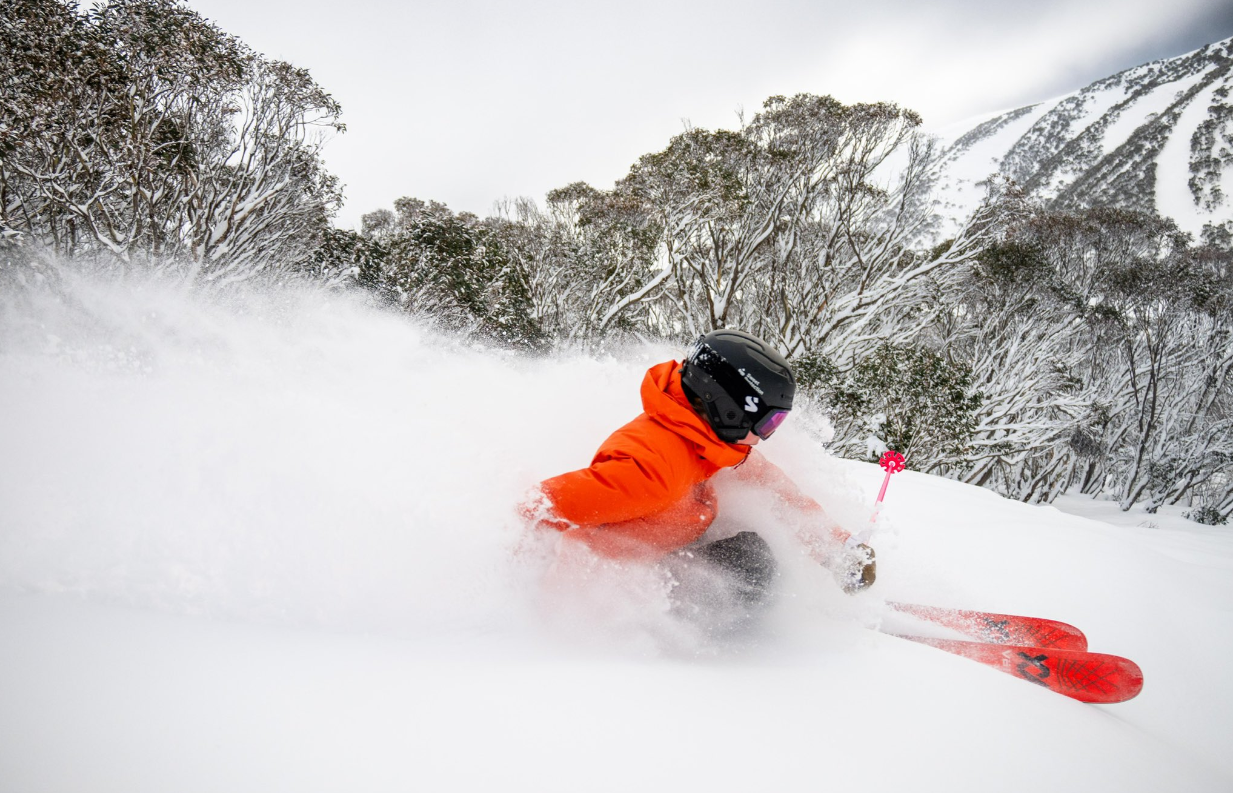
Image: We're not jealous at all. We love sitting at our desks on Aussie powder days, umm... well... sort of. Source: Chris Hocking
Little wonder that Hotham – Victoria's highest ski resort – has always billed itself as "Australia’s powder capital".
Over the border in the high country of NSW and the ACT, there were similar scenes. Conditions on Thredbo’s High Noon run were unbelievably powdery on Sunday morning, as these tracks by an early morning snowboarder (possibly a staff member) show.
Source: Live snow cams at Thredbo.com.au.
See that plume of wispy snow that blows away and almost appears to vanish? That right there is a sure sign of powder snow which is so light and wispy that you can’t form it into a snowball as the crystals won't bond due to a lack of moisture.
READ MORE: Low level snow in three states as a Christmas in July treat
Around 10 to 15 cm of snow was recorded over the weekend in most mainland ski resorts, with snow also recorded in much lower-lying areas beyond the mountains.
Snowfall accumulations weren't nearly as heavy as the previous weekend’s snowfalls, which is generally what happens with snow events accompanied by exceptionally cold, relatively dry airmasses.
But snow lovers will tell you that once you've got a good base (which we now do), it's all about the quality of the snow surface. And the smooth, dry surface is currently as good as gets.
The other good news for the ski resorts is that cold temps will stick around all week, keeping the snow in great condition and providing ideal conditions for snowmaking on key runs.
Meanwhile the southern half of the country – and even parts of Qld and the NT – will stay chilly for most of the week under mostly sunny skies.
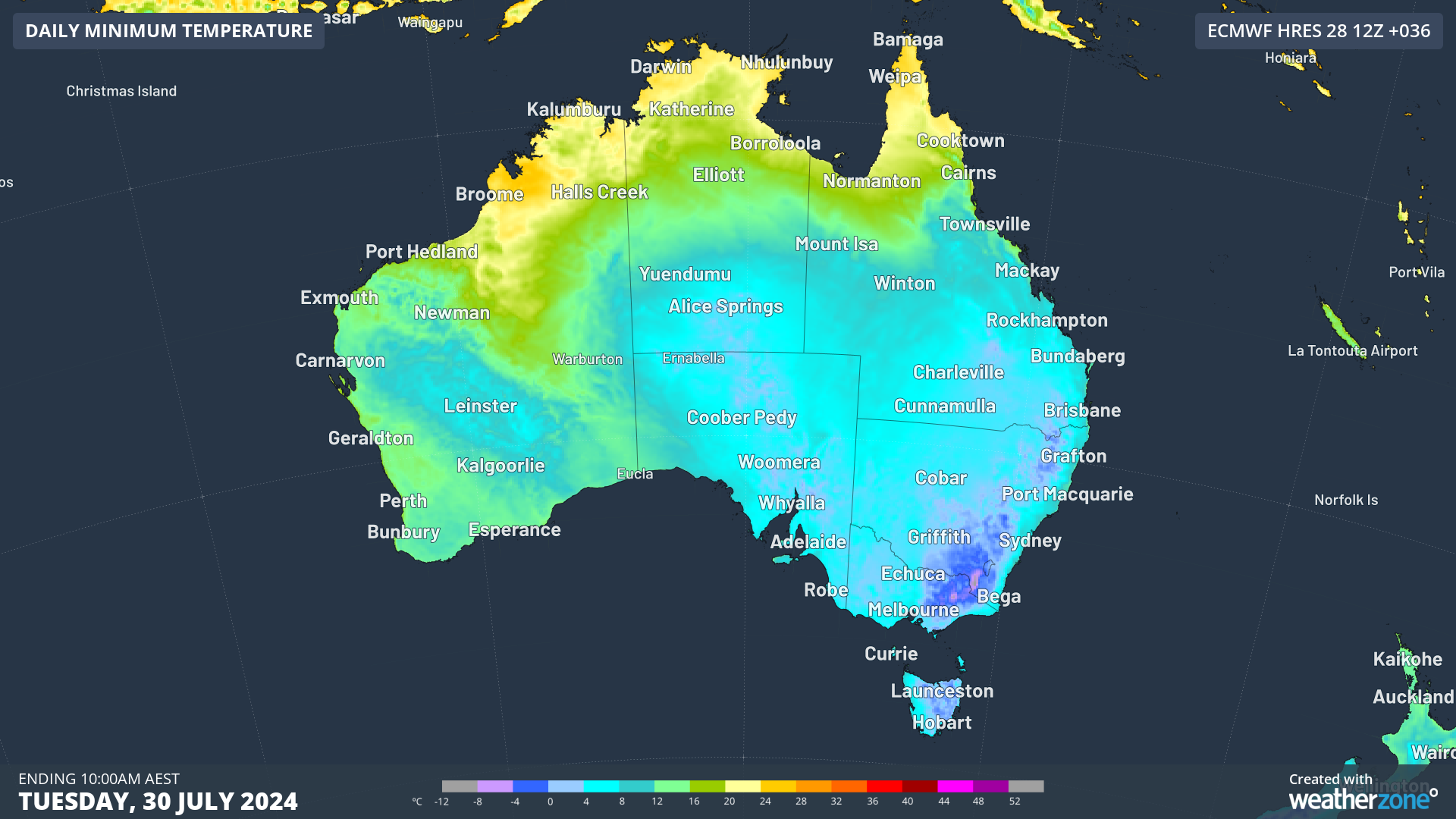
A string of very cold nights is on the way, with Tuesday dropping close to, or below, zero degrees across about half the country, as the chart above shows.