
Atmospheric gravity waves spotted off Australia's northwest coast
Satellite images have revealed a series of atmospheric gravity waves travelling to the northwest of Australia on Thursday.
The video below shows several roll clouds passing over the Indian Ocean to the northwest of Australia on Thursday, September 12.
Video: Visible satellite images captured by the Himawari-9 satellite on Thursday.
This series of roll clouds reveals the presence of atmospheric gravity waves travelling through the lower atmosphere, only a few hundred metres above the surface of the ocean.
Atmospheric gravity waves are ripples caused by air passing though the sky in a wave-like motion. Much like the ripples you see after throwing a stone into a pond, atmospheric gravity waves are caused when something causes a disturbance in a stable layer of the atmosphere, known as a temperature inversion. This disturbance can be a wind change, air passing over a mountain range or rising air inside a thunderstorm.
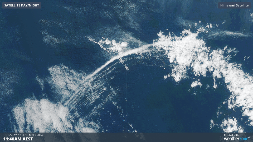
Image: Close-up view of the atmospheric gravity wave on Thursday.
Under the right conditions, atmospheric gravity waves can cause thin bands of cloud to form at the crest of each gravity wave, where the rising air has cooled enough to cause condensation.
Thursday’s atmospheric gravity waves were initiated by thunderstorms and a southerly wind change over the northwest of WA on Wednesday night. By Thursday afternoon, these gravity waves had travelled more than 900 km off the state’s northwest coast and were putting on a spectacular cloud display that could be seen from space.