
Atmospheric gravity waves off WA coast
While Australia's weather focus is on Tropical Cyclone Alfred just off the southeast Queensland coast, a remarkable phenomenon occurred overnight at the opposite end of the country.
Atmospheric gravity waves surged out over the Indian Ocean in a wide arc spanning hundreds of kilometres, triggered by storms in the Kimberley region.
Image: The waves came in several bursts as storms erupted overnight.
What are atmospheric gravity waves?
Have you ever thrown a stone into a pond and watched the ripples? Atmospheric gravity waves are just like that, but on a much larger scale.
When there's a disturbance in a stable layer of the atmosphere – like a wind change, air passing over a mountain range, or rising air inside a thunderstorm – ripples of air pass through the sky in a wave-like motion.
Under the right conditions, atmospheric gravity waves can cause thin bands of cloud to form at the crest of each gravity wave, where the rising air has cooled enough to cause condensation.
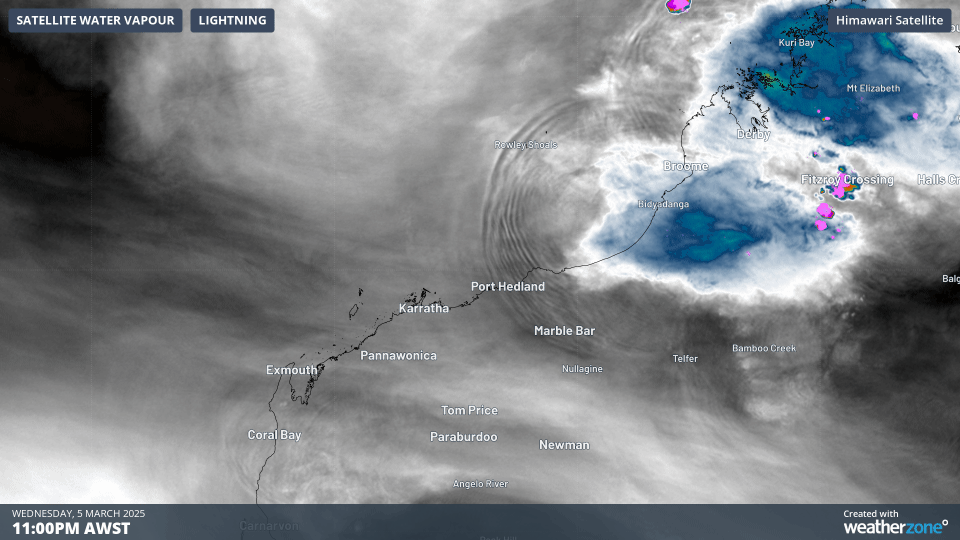
Image: Two-hour loop showing atmospheric gravity waves off WA on March 5 and 6, 2025.
What caused last night’s atmospheric gravity waves?
Severe thunderstorms over WA’s Kimberley region last night were the cause of last night’s atmospheric disturbance.
The intensity of those storms is reflected in the rainfall figures in the town of Derby on the Kimberley coastline, which received a 50mm downpour in just two hours in the small hours of the morning.
It’s worth noting that this part of the country has been extremely hot all week, even by local standards. For example, the mining town of Marble Bar in the Pilbara has kicked off March with five days of maximum temps between 42.5°C and 44.5°C – that’s around 3 to 5 degrees above the monthly average.
Humidity has also been high across much of the Pilbara and Kimberley regions, enhancing the thunderstorm potential.
In another piece of West Australian heat-related news, Perth is heading towards the 40-degree mark this Thursday. Should it make it, it would be the hottest autumn day in 13 years.