Another wet week for eastern Australia
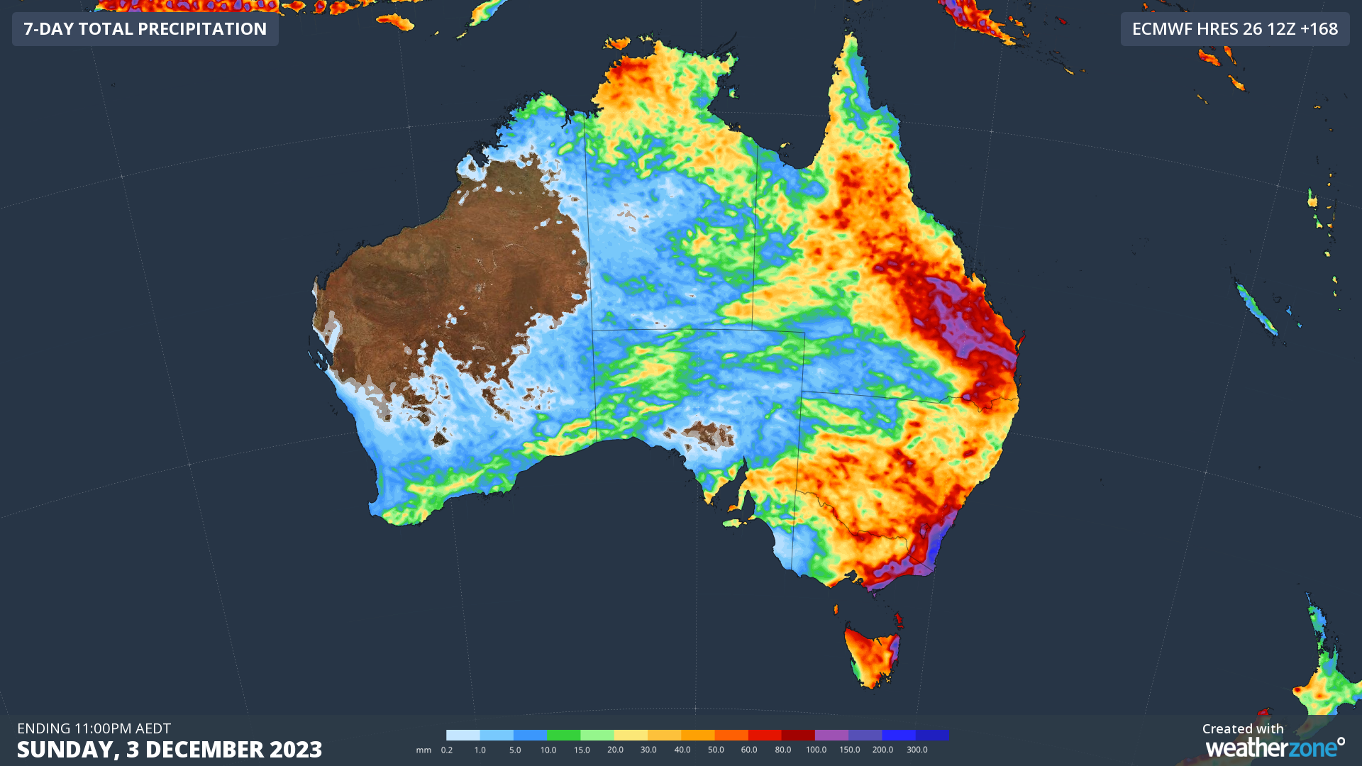
The wet November looks likely to continue in eastern parts of the country this week and the map illustrates the situation quite dramatically.
Over the next seven days, significant rain will fall in many areas, with accumulated rainfall totals of well over 100 mm possible (the blue and purple areas) in eastern parts of Queensland, NSW, Victoria, and possibly even Tasmania.

While both riverine and flash flooding possible as the week progresses, the rain should generally be good news for many people, including cheese lovers!
READ MORE: Why is Australia this wet in El Niño?
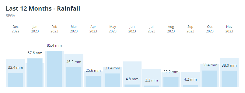
That dark patch on the NSW South Coast is right around the famous dairy town of Bega, and if you look at the graph below, you’ll see that Bega has had below-average rainfall in every month of 2023 to date since March.

The situation fuelling this week's coming rain and storm activity is relatively complex.
- Two upper level troughs are the drivers
- The first upper trough features an upper level low that will stall for a few days over the heart of the Murray Darling Basin
- The second one is already causing storms over southern WA today, and will drift eastwards throughout the week and eventually merging with the other system on Friday and into the weekend
If you're in any capital city (or nearby areas) other than Perth and you need to get a load or two of washing done, your best bet might be to get it out on the line as soon as possible this Monday.