Another wet week ahead for Australia
The negative Indian Ocean Dipole will continue to exert its influence on Australia over the coming week, with decent rain likely to fall in part of every state and territory.
We pointed out earlier this week that a negative Indian Ocean Dipole (IOD) had been declared to the northwest of Australia. This is the climate driver that typically increases rainfall over large areas of Australia during winter and spring by enhancing the strength and frequency of northwest cloudbands.
Well, it didn’t take long for the negative IOD to make its presence known.
The sequence of satellite images below shows a northwest cloudband producing widespread and heavy rain across southeastern and eastern Australia between Wednesday and Friday this week. This rain caused flooding in several states and inundated the mainland Alps with an unwelcome burst of winter rain.
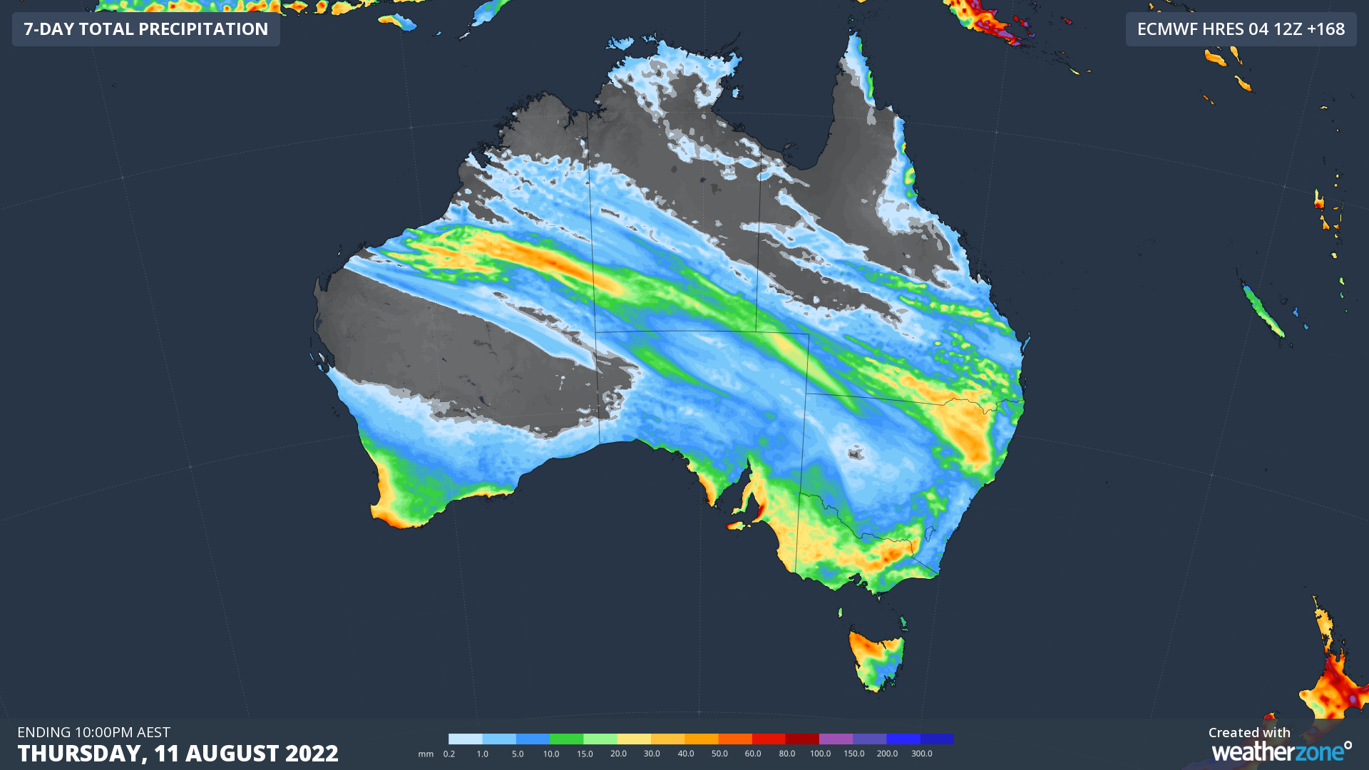
Now, forecast models suggest that another northwest cloudband could develop next week and link up with a low pressure system to bring more rain to parts of every state and territory.
The map below shows how much rain is predicted during the next seven days according to one computer model. While it is still too early to know how next week’s cloudband will evolve, there are already strong signs that it will produce widespread rain that could be heavy in some parts of the country.

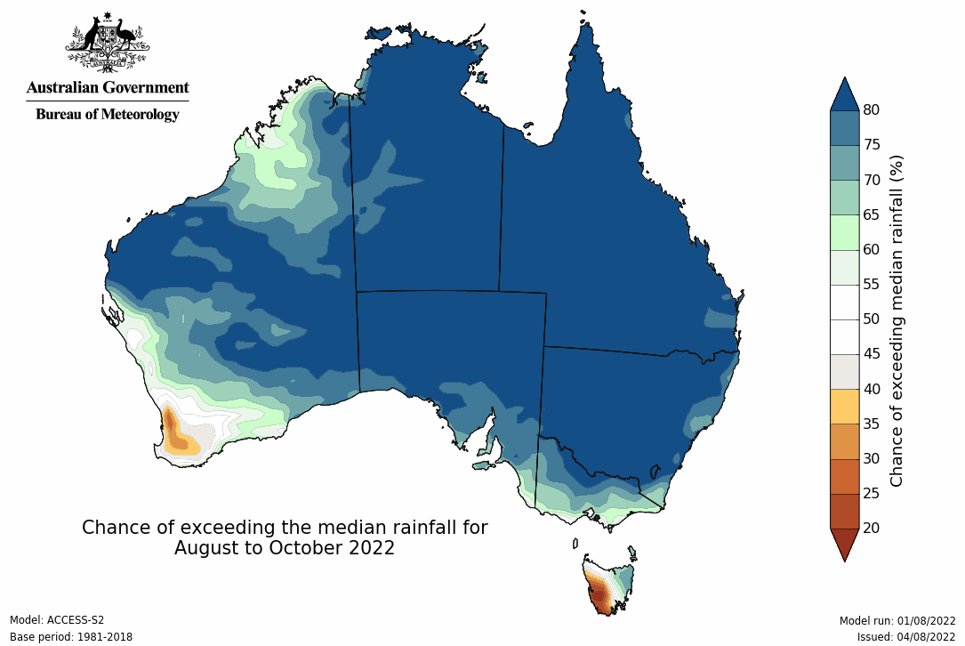
These transcontinental rain-bearing cloudbands are likely to be a regular visitor over Australia during the rest of winter and spring under the influence of the negative IOD. Just take a look at the latest seasonal outlook for rainfall between August and October.

Image: Rainfall outlook for the next three months combined (August to October). Source: Bureau of Meteorology.