Another southwest WA rainy spell
The incredible transformation in southwest WA continues, with yet another prolonged wet spell on the cards from this Thursday through to the weekend.
Just five months ago, we wrote about jarrah trees drying in the big dry, as large parts of the southwest had their driest six-month period on record from October through to the end of March.
Then earlier this week – after a winter of consistent rainfall in line with what is the region’s climatological wet season – there were record 24-hour rainfall totals in many locations.
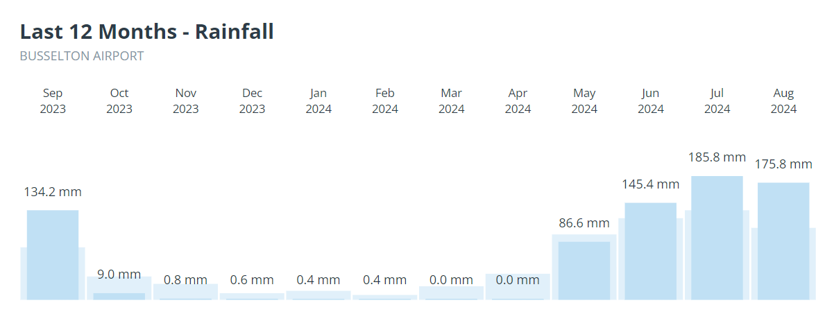
One of those locations was Busselton, gateway to the Margaret River surf and wine region, where no month registered even a millimetre of rain in the unprecedented dry spell.

As the graph above shows, it has been quite the turnaround in Busselton, as it has across virtually all of the southwest.
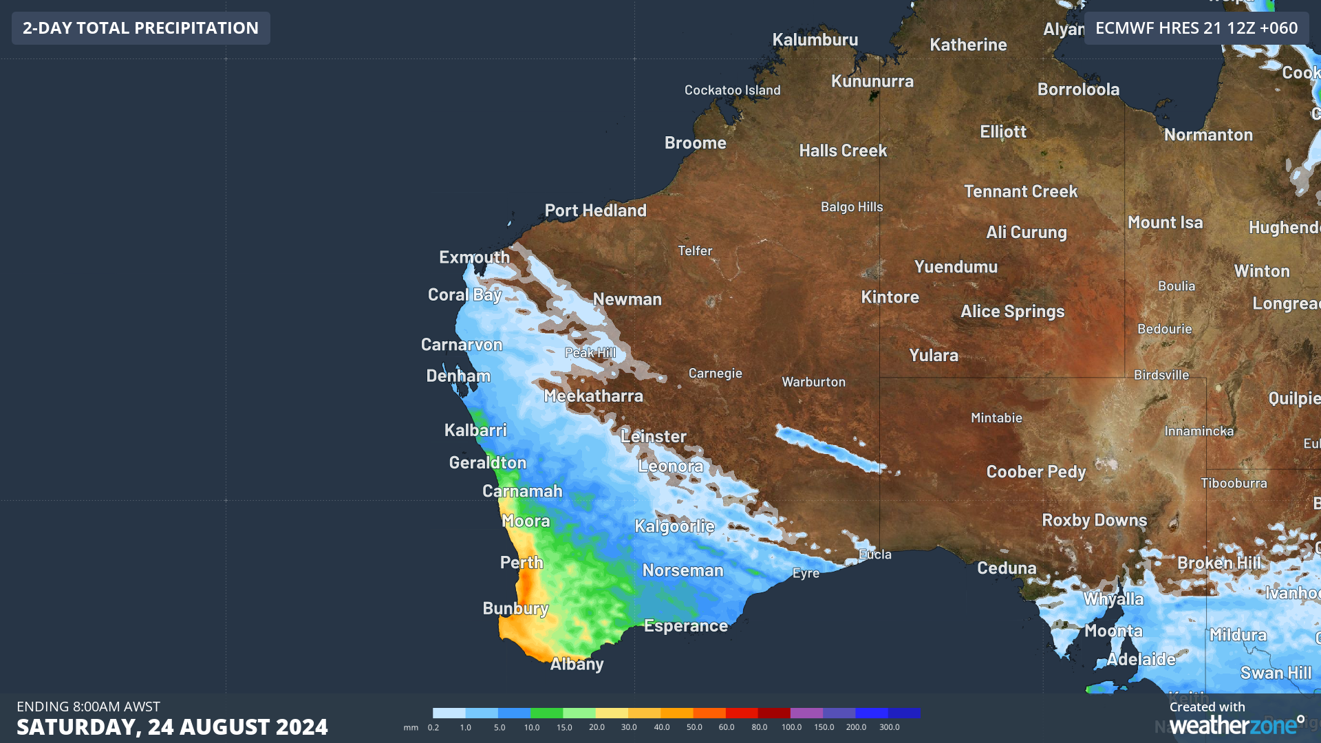
And that wet trend is set to continue in the southwest as we head towards the last week of winter. The chart below shows the expected rainfall accumulation by Saturday morning, with 20 to 50 mm (the red and orange zones) expected in coastal locations and nearby elevated terrain.

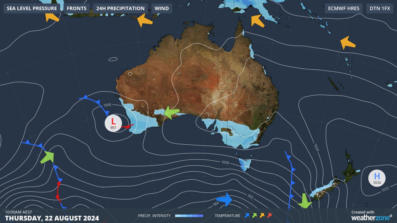
Rain is already falling this Thursday in a relatively mild airmass ahead of the first of two cold fronts, with totals around 5 mm in the Perth metro area and slightly higher totals further south.

Showers will persist after the passage of the first front, then re-intensify as the second approaches, with temps dropping a few degrees on Saturday in cooler air behind that second front.
If you're sick of the winter rain by now, that's understandable, but bear in mind that the BoM's long-range forecast for September through November shows that drier than average conditions are likely for large parts of the western half of Australia.