
A wintry Sunday in Tassie
A burst of wintry weather will bring wild winds, rainfall, low-level snow, and possible hail and thunderstorms to Tasmania on Sunday.
While most Australians are enjoying dry and settled conditions this weekend under a firm high, Tasmanians will confirm that winter is not over yet as a vigorous front is set to cross the region.
This system will generate powerful winds across the state with peak gusts in some places, including Hobart, exceeding 100km/h; some elevated and exposed locations may see gusts above 125km/h. A severe weather warning for damaging, locally destructive winds is in place for all districts of Tasmania. The strongest west-northwesterly winds are expected to peak during the morning and early afternoon before starting to ease late in the day as the front moves away.
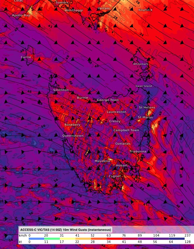
Image: Surface wind gust on Sunday midday according to ACCESS-C.
Showers and rain will affect the west and north of the Apple Isle in the early morning and spread across the entire state as the day progresses. The heaviest falls, 30-40mm, are likely to occur in the west whereas the east should see less than 10mm. As temperatures will drop significantly from late afternoon, in the wake of the front, rain will become snow as low as 600 metres in the south. Storms and small hail may also feature during this event.
Cool southwesterly winds will maintain the wet weather on Monday with snow falling to around 500 metres in the morning, and damaging winds possibly becoming confined to the exposed southern coasts as high pressure gradually builds from the west.