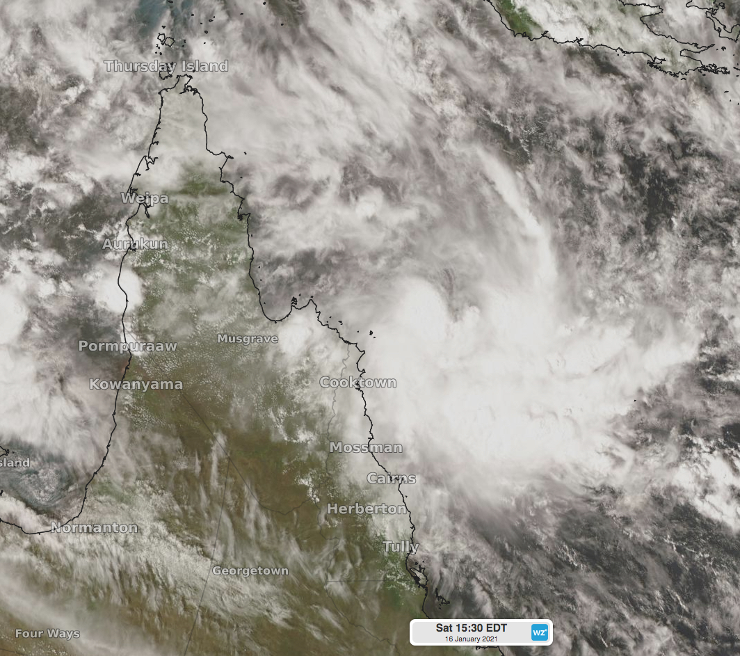
A tropical low starting to cause concern in northeast Queensland
A developing tropical low off Queensland's North Tropical Coast may deepen in the coming days, causing some concern for forecasters and coastal communities.
On Friday, a deep low started appearing in some forecast models, and not in others. On Saturday, some of the models showing the low had weakened, however some of the models not showing it on Friday were now signaling the formation of a deep tropical low. This uncertainty is causing concern for forecasters, and should a tropical low form, or potentially a tropical cyclone, it is likely to impact already saturated parts of northeast Queensland.
A weak tropical low has formed within a trough off northeast Queensland, and is expected to slowly move south in the coming day or two. The environment is favourable for the low to strengthen, however other aspects come into play, such as the low's proximity to the coastline.
Currently, the chance of a tropical cyclone forming is low, up from very low on Friday. If a tropical cyclone does form, it will be called Kimi.
 Image: thick cloud with a weak tropical low off Queensland's North Tropical Coast, likely to bring heavy rain and high winds in the coming days.
Whether or not a tropical cyclone forms, the low should bring heavy rain to parts of an already saturated northeast tropical Queensland, along with possibly damaging winds. Between now and mid next week, rainfall exceeding 250mm is possible about the North Tropical Coast, with higher localied falls a chance depending on the movement of the low. Coastal parts of adjacent districts should also see very high rainfall in the coming days.
Like most complex tropical systems, forecast models are likely to change significantly from run to run, keeping forecasters busy. Residents of northeast Queensland should keep up to date with warnings whether or not a tropical cyclone forms, as flooding is a high risk. Warnings can be found at https://www.weatherzone.com.au/warnings.jsp?lt=wzstate&lc=qld