
800km line of thunderstorms about to hit Australia’s west coast
A cold front is on its way to Western Australia and it is expected to bring a cool weekend to the country’s southwest.
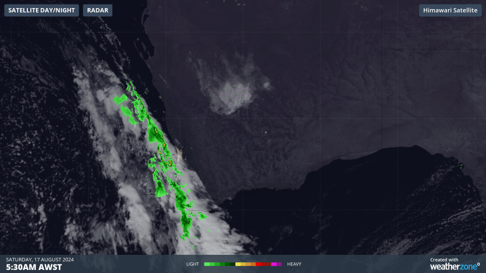
Fig. 1) Loop of satellite images of the current front and radar of rainfall from 5:30am AWST to 8:30am AWST
Looking at the current satellite imagery (Fig. 1) it can be seen that a long line of cloud is reaching the WA west and southwest coasts, bringing along some heavy showers, gusty winds and thunderstorms. A severe weather warning was issued by the Bureau of Meteorology for heavy rainfall along the Lower West and South West districts. In the 24 hours to 9am, rainfalls exceeding 80mmwas observed in the Lower West (Fig. 2) with showers expected to continue for the southwest of the state through the day, possibly becoming heavy in the afternoon (Fig. 3).
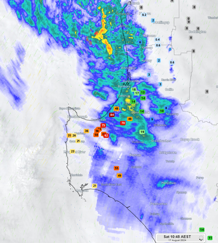
Fig. 2) 24hr rainfall total to 8:45am AWST as observed in different locations of Lower West and South West
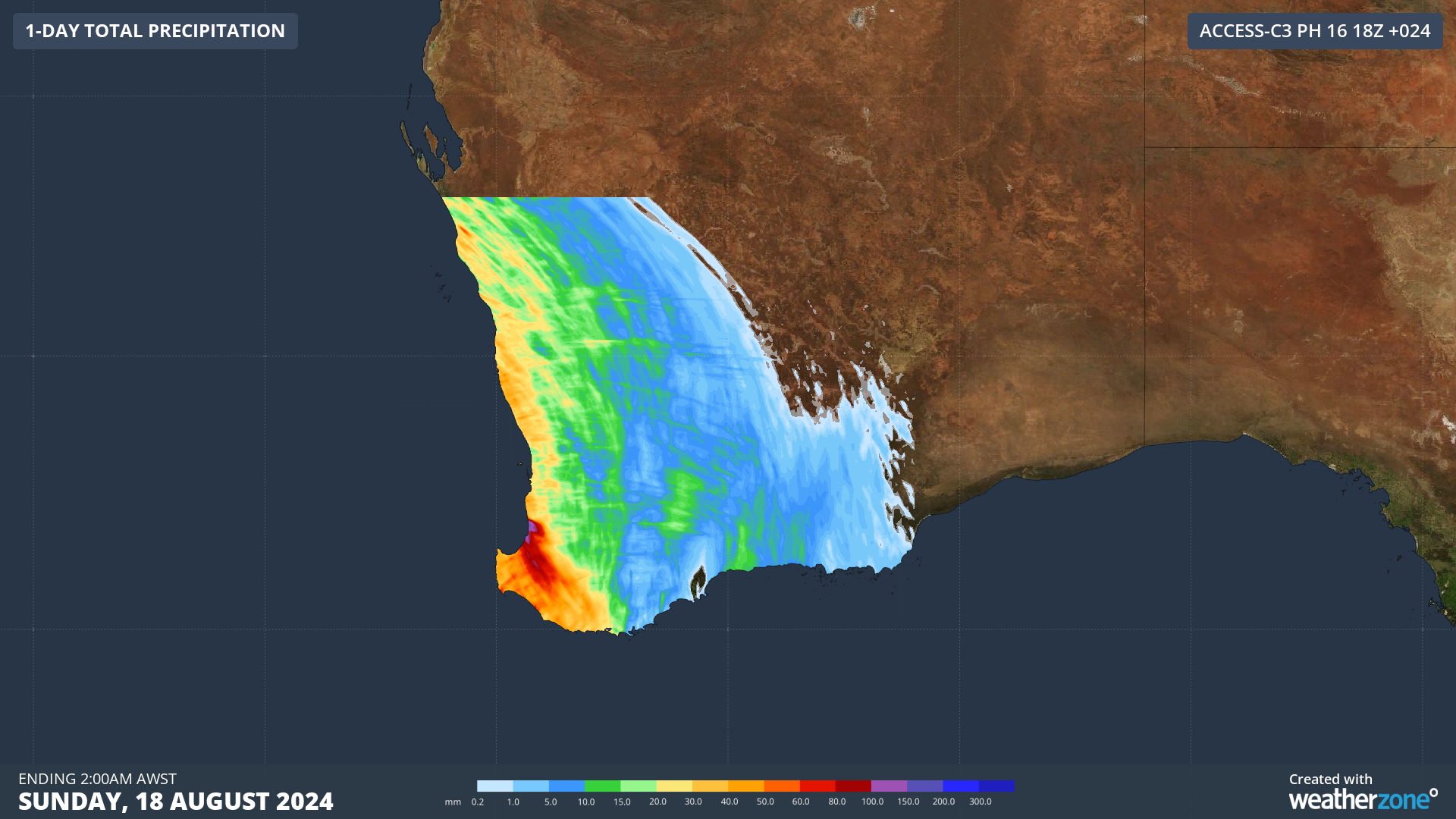
Fig. 3) Forecast of 24hr rainfall up to 2:00am AWST for western WA
Storms along the frontline were first detected at 10:40pm AWST, 114km off the coast of Amberton Beach, Eglinton, WA. To 9:30am AWST, there have been a total of 70,332 strikes offshore, and with sunshine just starting, these storms are expected to pick up energy and persist through the day.
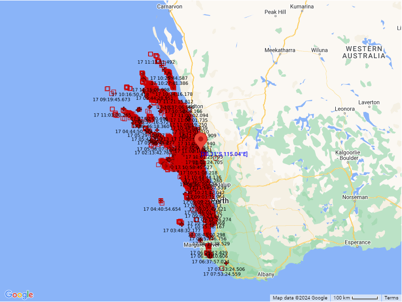
Fig. 4) Total lightning strikes detected across the west coast from 12:00am AWST to 11:22am AWST on Sat 17th
Though the strongest of winds, heaviest of showers and severe thunderstorms have not yet arrived for further up the coast, gloomy clouds and the heavy fall over the water can be seen offshore through the local water-facing cameras:
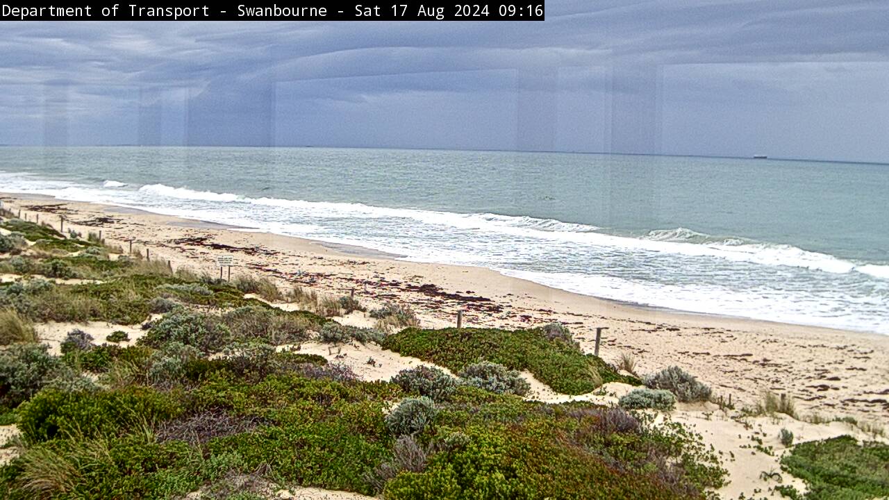
Fig. 5) Photo of the Swanbourne Beach at 9:16am AWST from the Department of Transport (Gov of WA)
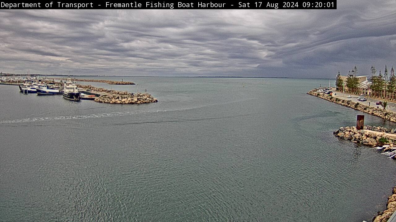
Fig. 6) Photo of the Fremantle Fishing Boat Harbour at 9:20am AWST from the Department of Transport (Gov of WA)
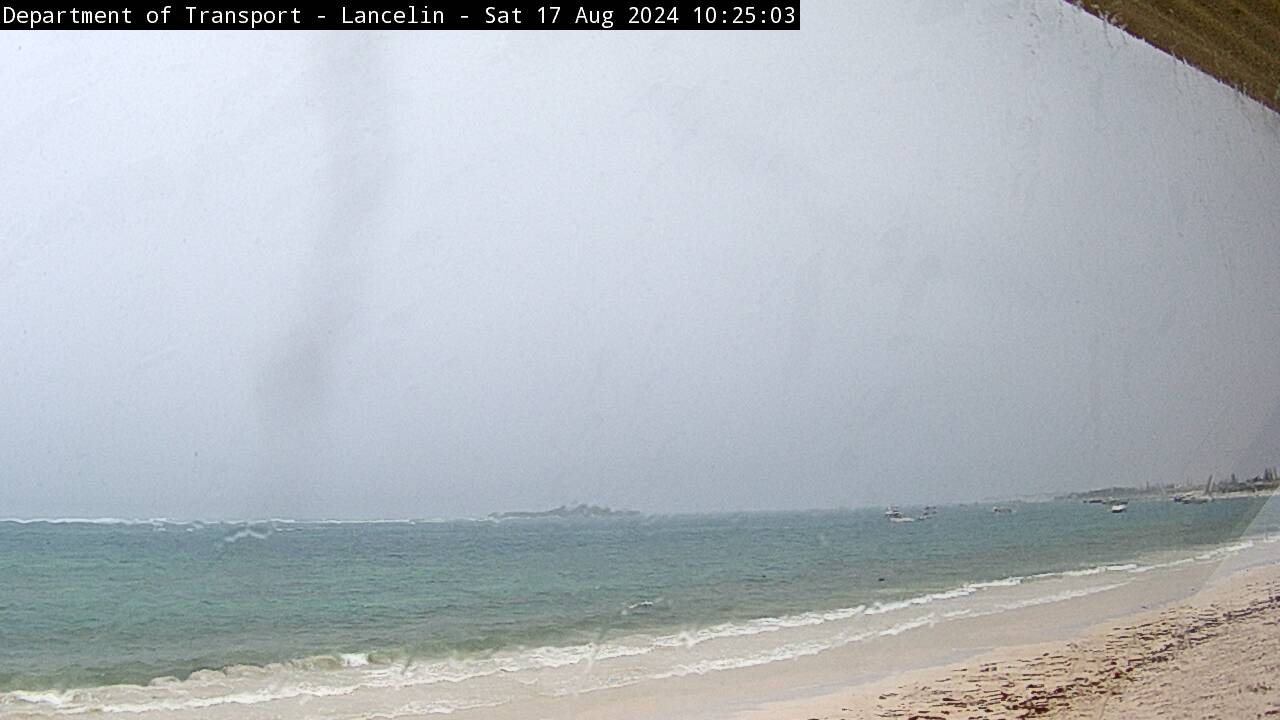
Fig. 7) Photo of the Lancelin at 10:25am AWST from the Department of Transport (Gov of WA)
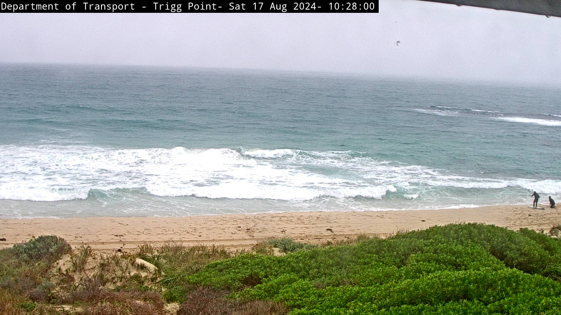
Fig. 8) Photo of Trigg Point at 10:28am AWST from the Department of Transport (Gov of WA)
This crossing system is expected to drop temperatures in WA by a few degrees, but the combination of clouds, winds and rain will make it feel 3-6 degrees cooler than actual across the board. Sunday looks to be particularly cool as winds turn blustery southwesterlies pushing more cool air across the state’s south and west. So do not pack those winter jackets just yet WA, as the weather seems to want to stick it out before the season officially ends.