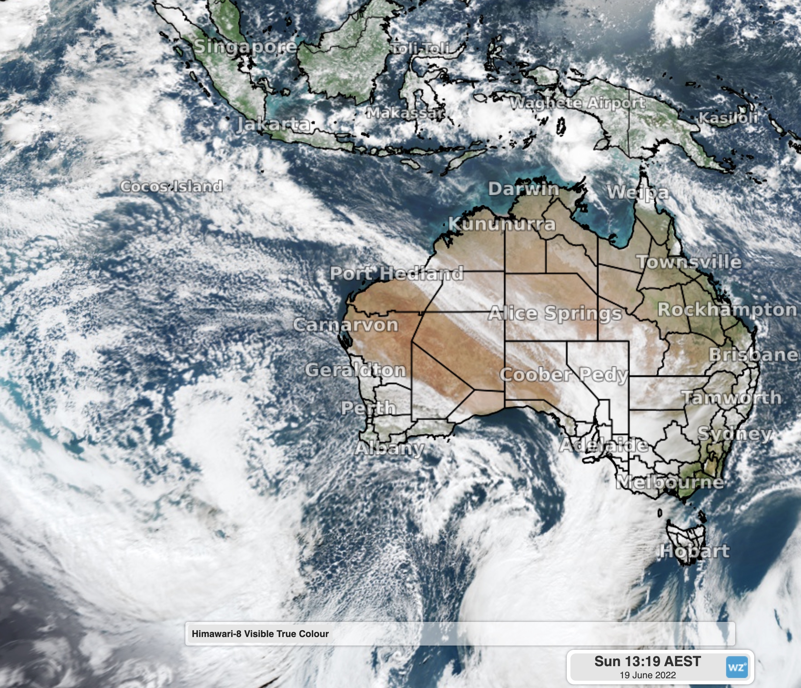
7000km long cloudband stretches across the country
Stretching all the way from the equator to Melbourne, a long cloudband is bringing patchy rain, a sign of things to come this winter and spring.
A broad trough connected to a cold front in the south has been building in the Indian Ocean over the last few days. After yesterday's crossing of southwestern parts of WA, the cloud is now stretching all the way from a tropical disturbance near the equator just south of Sri Lanka, all the way to the northwest near Port Hedland, across Uluru, to Victoria, and later on Tasmania.

Image: Satellite showing the cloudband stretching from the equator to Victoria
Cloudbands like this are fairly common during a negative Indian Ocean Dipole (IOD) event, something that is likely to develop over the next few weeks. The IOD is fairly similar to the more commonly known El Niño and La Niña events that occur in the Pacific Ocean, with La Niña being the most similar to a negative IOD for Australia.
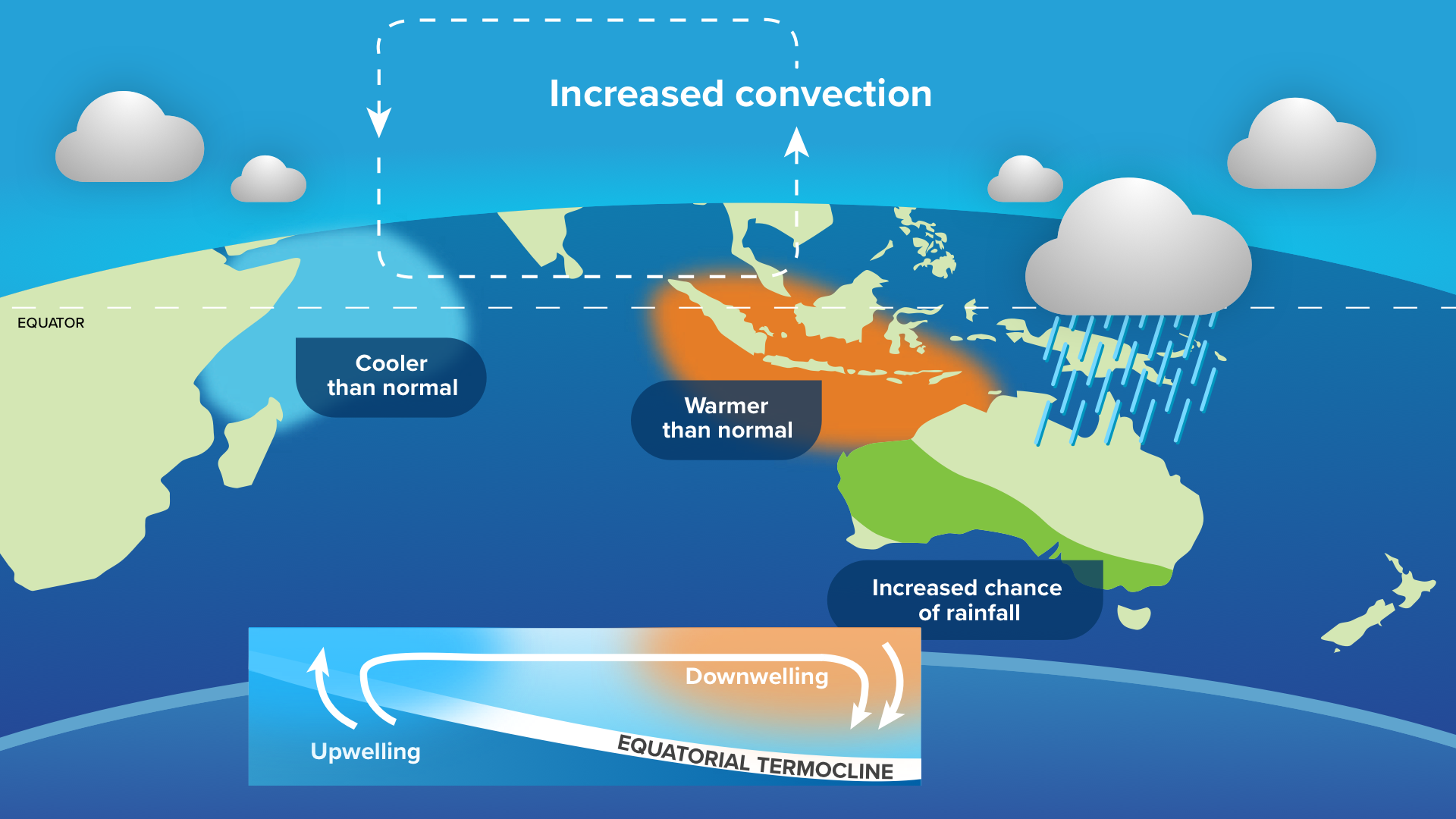
During a negative IOD, warmer waters stay near the northwest shelf of Australia. This moisture can fuel vast northwest cloudbands, like the one today, which can cause widespread rain, thunderstorms and flooding, especially west of the Great Dividing Range. The map below shows how negative IOD events typically affect Australia’s winter-spring rainfall.

Image: Diagram of a negative IOD, and its effects on the oceans and rainfall
As the Bureau of Meteorology have mentioned on their climate outlook “All five international climate models surveyed by the Bureau indicate a negative IOD event could develop during early to mid-winter". This means that a negative IOD event is a high chance to develop in the next few weeks, which then typically lasts through until around November or December.
Keep tuned at Weatherzone for news on this developing climate driver.