
20 degrees difference: Sydney swelters while Melbourne shivers
We all know Sydney and Melbourne are different in too many ways to count. Surf beaches versus laneway culture. Two football posts on most ovals versus four. Potato scallops versus potato cakes.
We also know that Sydney and Melbourne can have wildly different weather on the same day - and today, the contrast is about as stark as it gets.
Sydney is sweltering in temperatures in the low thirties, with readings at 1:30 pm of 32.5°C in the city and 33.4°C in Penrith in the city's outer west.
Meanwhile, Melbourne shivers in temperatures that refused to climb into double digits until just before midday. By 1:30 pm, the Victorian capital had reached 11.7°C, on its way to a forecast top of just 14°C.
Melbourne Weather, I am sooooo in the mood for you today. I love you 💕😘â¤ï¸ 🌧 â˜”ï¸ â˜ï¸ pic.twitter.com/0EU7A3WzUD
— Magda Szubanski AO (@MagdaSzubanski) October 4, 2020
That means the temperature gap between Sydney and Melbourne’s two official city stations (Observatory Hill and Melbourne Olympic Park) at 1:30 pm was a whopping 20.8°C.
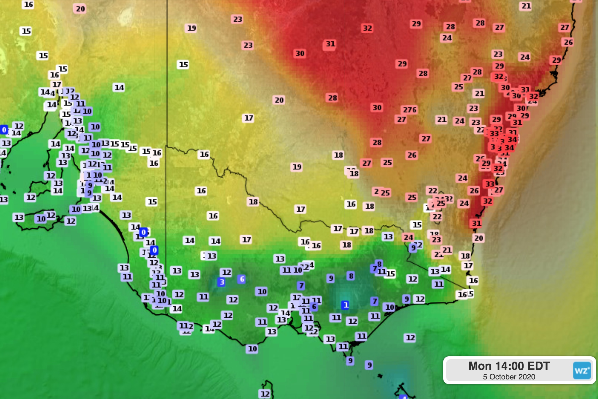
Image: Observed surface temperatures at 2pm AEDT on Monday.
This may seem like an unusual contrast, given the average daily maximums for October are 22.2°C in Sydney and 19.7°C in Melbourne – just 2.5°C apart.
Why such a difference this Monday?
The Monday synoptic chart reveals all. A brief burst of Southern Ocean air behind a cold front has surged through Victoria, while NSW is still basking in warm northerlies ahead of the front. This weather pattern is typical of spring and often causes large temperature contrasts between eastern NSW and southern Victoria.
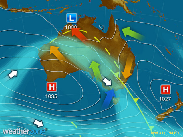
Image: Synoptic chart for Monday afternoon, showing warm air (orage arrow) moving into NSW ahead of a front, while cooler air (blue arrow) flows over Victoria in the front's wake.
The southerly air will reach the Harbour City later on Monday evening, bringing a much cooler maximum of around 21 on Tuesday.
Sydney temperatures will then hover in the low twenties on Tuesday and Wednesday before warming slightly later in the week. The chance of showers will be highest on Wednesday and Thursday.
Melbourne will stay cool for this time of year, with another day of temperatures in the low to mid-teens on Tuesday.
The Victorian capital is unlikely to warm up beyond the high teens for most of the week, with the chance of showers most days. Sadly for those seeking a taste of summery weather within five kilometres of their home, there won't be anything like last weekend's consecutive 29-degree days for at least another couple of weeks.