146 km/h winds at the top of Australia
It was a wild old night in the Australian high country with winds the strength of a category two cyclone and rainfall totals also reminiscent of tropical weather events.
As the northwest cloudband marched across the country on Thursday, its effects intensified overnight in the mountains where some of the remarkable observations in the 24 hours to 9 am Friday included:
Wind observations
- A 146 km/h wind gust just before 8 pm at Thredbo Top Station – Australia's highest weather station located at an elevation of 1957m close to the top of Thredbo's Kosciuszko Chairlift.
- That equalled the May record and was close to the record gust of 154 km/h for that site, which has operated since 1966.
- Australia's second-highest weather station at an elevation of 1849 m at Mt Hotham in Victoria recorded gusts of 135 km/h around the same time as Thredbo,
- Wild winds also lashed Tasmania on Thursday night and continue to do so on Friday morning, with gusts exceeding 100 km/h already recorded at 10 or more locations today. That includes kunanyi/Mt Wellington above Hobart.
- Another Victorian ski resort, Mt Buller, equalled its May record with a 133 km/h gust.
Rain observations
- Thredbo Top Station also received a drenching of 85.8 mm of rain overnight.
- Mt Hotham received 116 mm of rain which was the heaviest reading anywhere in the country.
- But the extremely heavy rain wasn’t confined to the high country. Three Victorian weather stations just west of the mountains recorded a tick over 100 mm too, including Strathbogie North with 109 mm.
- Tasmania also saw welcome falls of 50 mm or more at several locations in the northern half of the state, which has been very dry to date 2024.
- Rain also fell in far western NSW, including the tiny town of Tibooburra (pop 130) which received 28.4 mm, which is almost double the average for the entire month of May.
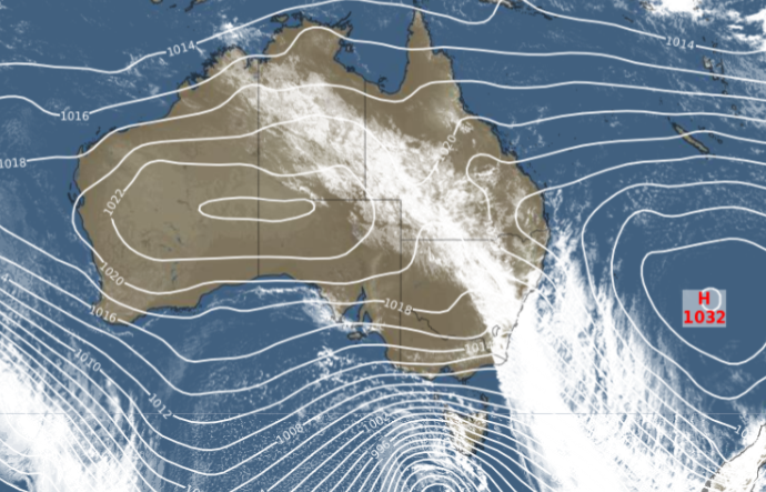
As ever with an event like this, the isobars tell the story.

See how close together they are near Tasmania? That indicates a strong pressure gradient – which means air pressure changing dramatically over a short distance. In simple terms, it means wind.
Back in the mountains, all that wind and rain would be terrible news for snow if the season had started, but fortunately, the official season start is not till the long weekend next weekend and there was no natural snowpack to erode. That’s the glass half-full take on last night’s weather.
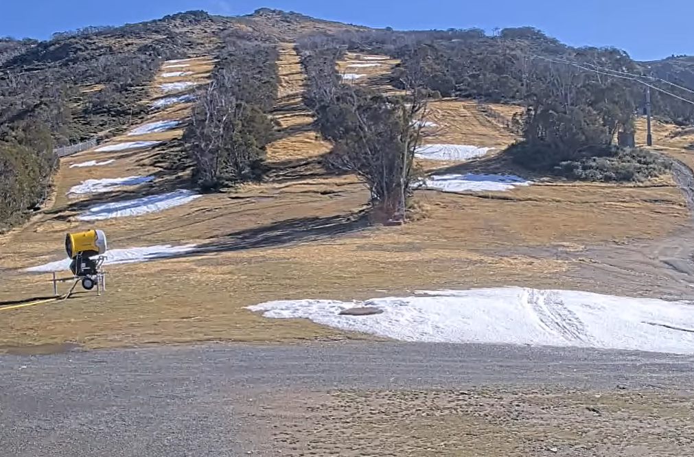
The glass half-empty view is that much of the pre-season snowmaking made possible by the run of recent chilly nights has been washed away.

Source: Thredbo.com.au.
Snowmakers concentrate their efforts in humps that they call "whales" to help preserve their precious snow. These humps are then spread out over the slope just before the lifts open.
Unfortunately, the whales are looking a bit more like minnows this Friday morning as the sun comes out over the mountains.
There remains the potential for light snowfalls later this weekend with a few centimetres also possible midweek, but the chance of a significant snowfall coating slopes beyond the snowmaking areas for the long weekend now appears unlikely.
Please check our warnings page as numerous alerts remain in places for many areas.