
12 hours of relentless rainfall in Mackay
The city of Mackay is the latest place in Queensland to receive sustained heavy rainfall, with over 100mm falling in the 12 hours from midnight Thursday to midday Friday, as a moist onshore feed interacted with a coastal trough.
The local rainfall was even heavier in the ranges to the west of the city, with 274mm recorded in the 24 hours to 9am Friday at Teemburra Dam – Mackay's main water catchment which is currently at 107.6% of capacity.
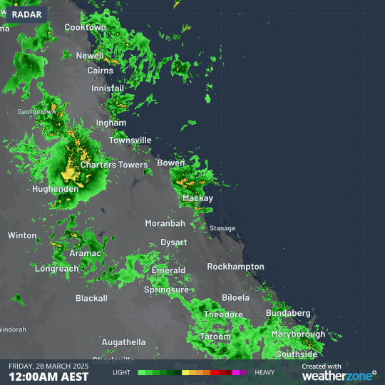
Image: 12-hour radar loop showing sustained precipitation centred on the Queensland city of Mackay.
A major flood warning is in place for Mackay’s Pioneer River, with minor to moderate flooding likely in Mackay itself on Friday evening as the floodwaters coincide with the high tide at 10:18pm.
This has been a remarkable month of Queensland rain
Many parts of Queensland experience extremely wet weather in a typical summer, but March 2025 has still been an exceptional month for Qld rainfall.
- Earlier this month, Brisbane had its wettest day in half a century in the wake of Tropical Cyclone Alfred.
- In recent weeks, Townsville has received numerous deluges, with a soggy spell that included its wettest day in 27 years.
- Then this week, moisture spread inland as vast parts of inland and western Queensland received a thorough soaking, with records broken at numerous locations.
The map below shows Queensland's rain over the past week. Basically, it has rained everywhere, with blue and purple areas showing locations which have received 100mm or more.
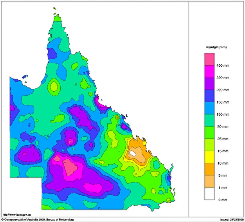
Image: Weekly rainfall totals for Qld from 22 March, 2025 to 28 March, 2025. Source: BoM.
As for Mackay, showers – possibly heavy – will continue for the next week or so, although Queensland’s seventh-most-populous city may not see rainfall as sustained and intense as the rain that fell this Thursday and Friday.