
1000-kilometre rainband soaks WA coast
Heavy rain is falling on the Western Australian coastline in a rainband stretching nearly 1000 kilometres from south of Perth to Ningaloo Reef in the Gascyone forecast district.
This was the scene in Geraldton around midday (AWST) as the clouds moved in, with 9.4mm of very welcome rain accumulating in just 90 minutes between 10:30am and 12pm.
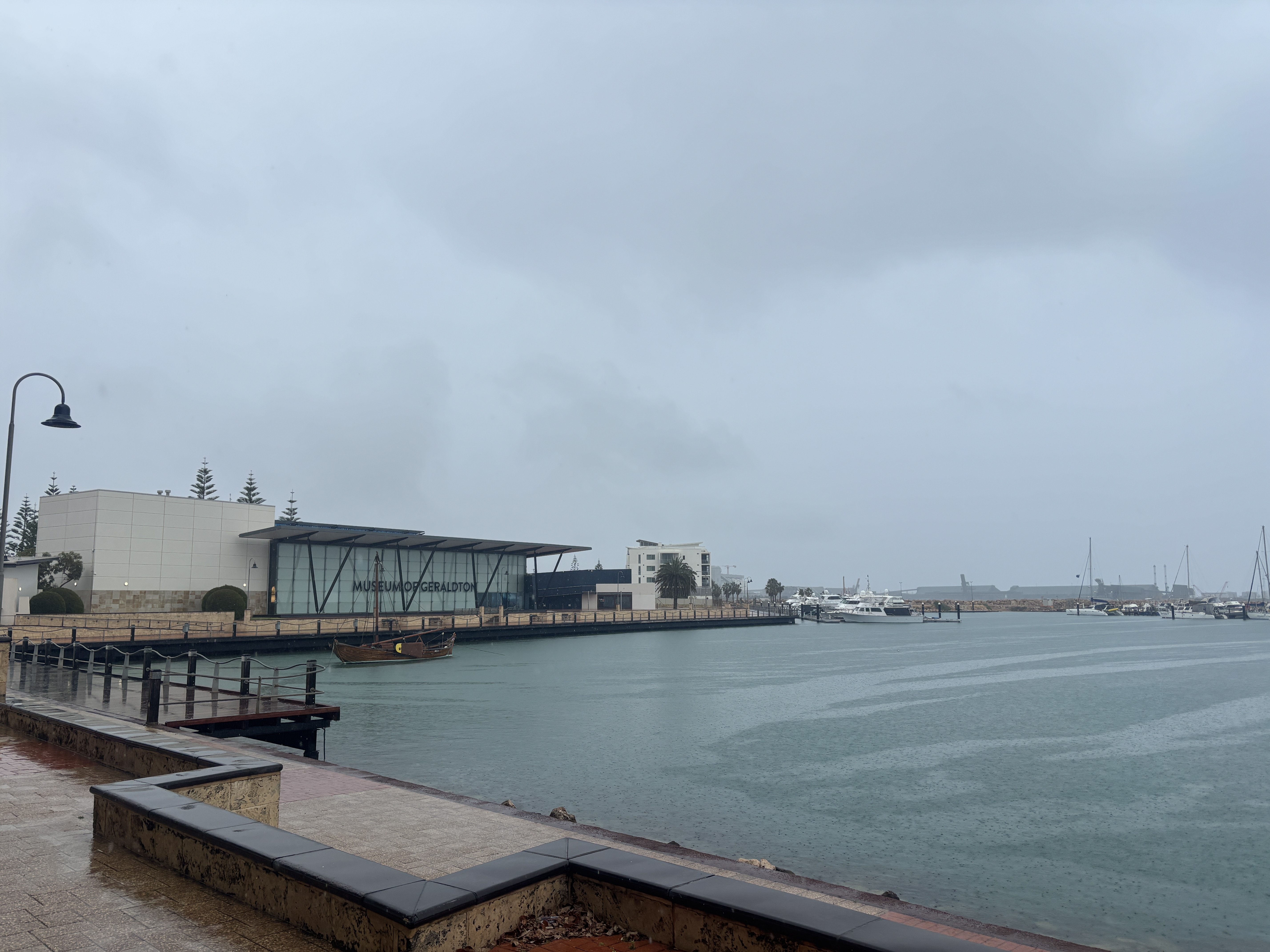
Image: Locals didn't mind a bleak Wednesday afternoon knowing that dry times lie ahead. Source: Matt Poynton.
The rainband is associated with an upper level trough ahead of a cold front. You can see the tell-tale speckled cloudmass which is usually associated with cold fronts on the left of the two-hour radar loop below.
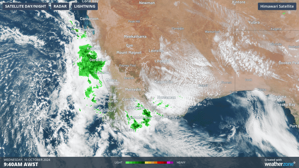
Image: Speckled cloud fields form when very cold air moves over warmer ocean, causing individual cumulus clouds to develop over a broad area with patches of clear sky in between.
READ MORE: Speckle-tacular cloud field as Perth pelted
Moisture from this system is expected to be relatively short-lived, with only light showers to follow in southwestern WA from Thursday onwards, so Wednesday afternoon's rain will be appreciated by locals as the southern dry season approaches.
Last summer was of course exceptionally dry even by the southwest's usual summer standards, with Perth registering its driest seven months on record from October to April.
As the graph below shows, it was a similar situation in Geraldton, the city of almost 40,000 residents which is the most populous place on the WA coastline north of Perth.
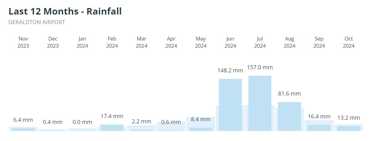
Image: Three good months of winter rain is all that Geraldton can (usually) rely on, so a decent drop from mid-spring onwards is always a bonus.
A significant fall of 25.2mm between 9 am and midday was also recorded this Wednesday on North Island, a speck of land in the Houtman Abrolhos, a coral reef archipelago about 80 km west of Geraldton. The island is home to a small seasonal population of rock lobster fishermen.
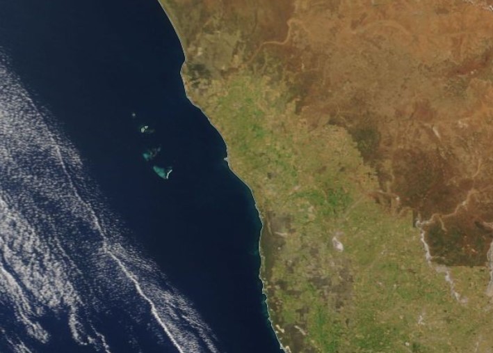
Image: North Island is the northernmost speck in the cluster of islands in the satellite image. Source: NASA Worldview.