
Cold temps, strong winds, thunderstorms, snow, and rough seas for NSW next week
Enjoy the settled weekend NSW because a cold front crossing on Tuesday will bring a range of wild weather from Monday to Wednesday.
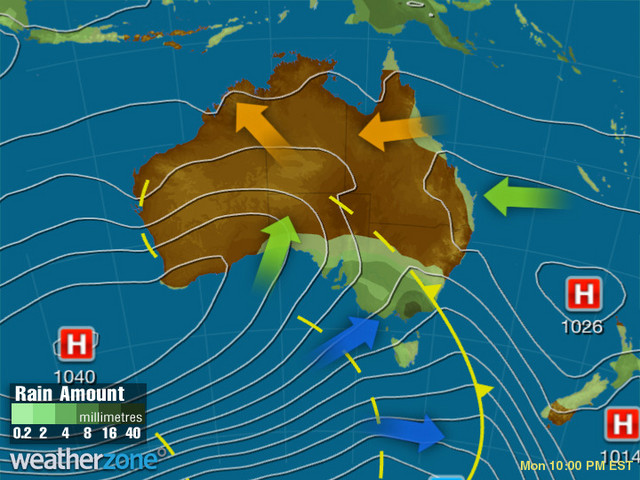
Image: Synoptic chart for 10pm AEST Monday 22nd
Ahead of the front on Monday, warm winds blowing from the northwest will pick up, reaching 70-80km/h over the Southern and Central Tablelands. Then the front will move through southern and western NSW on Monday night, delivering rain and spreading a massive pool of cold air.
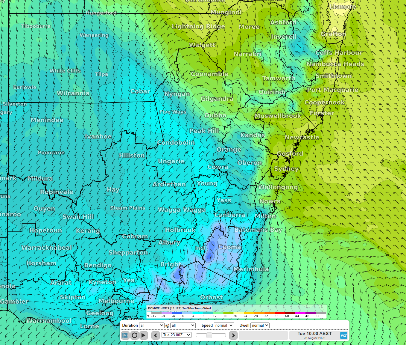
Image: 10m winds, 2m temp at 10am AEST Tuesday 23rd (ECMWF model) showing colder temperature behind the front in blue
This may produce an uncomfortable temperature contrast for some places. For example, Broken Hill is forecast to reach a top of only 13C on Tuesday after reaching a nicer 21C on Monday.
With the front pushing through, snow will fall over the Snowy Mountains on Monday night and the Southern Tablelands on Tuesday morning, and as the cold air spreads further north, snow will fall over the Central Tablelands and the Northern Tablelands overnight on Tuesday with a few centimetres accumulating by Wednesday morning. This may produce a delightful snowy landscape for some but also pose some risk on the roads.
Meanwhile, as the front produces rain and showers, a trough ahead of the front should trigger thunderstorms during Tuesday afternoon across Greater Sydney, the Hunter and further north around the ranges, producing plenty of flashes of lightning and rumbles of thunder and potentially damaging wind gusts.
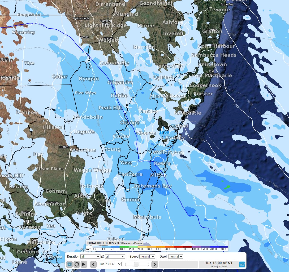
Image: 3 hourly precipitation at 1pm AEST on Tuesday 23rd (ECMWF model)
As if that’s not enough, a powerful low-pressure system may form off the coast as the front crosses the coast on Tuesday night. This low could potentially cause damaging winds along the coastal fringe overnight into Wednesday morning, possibly between the Illawarra and the Hunter, as well as cause heavy showers, and quickly whip up rough seas. Fortunately, the low would be able to move quickly away from the coast on Wednesday morning and head out to churn up the Tasman Sea before crashing down on New Zealand on Wednesday or Thursday.
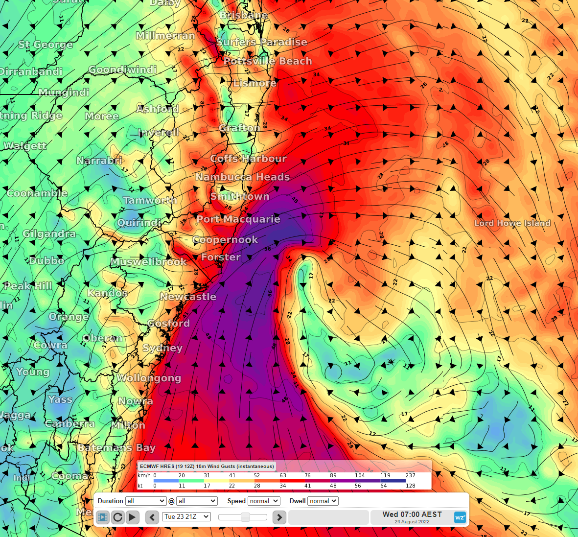
Image: 10m wind gusts at 7am AEST on Wednesday 24th (ECMWF model)
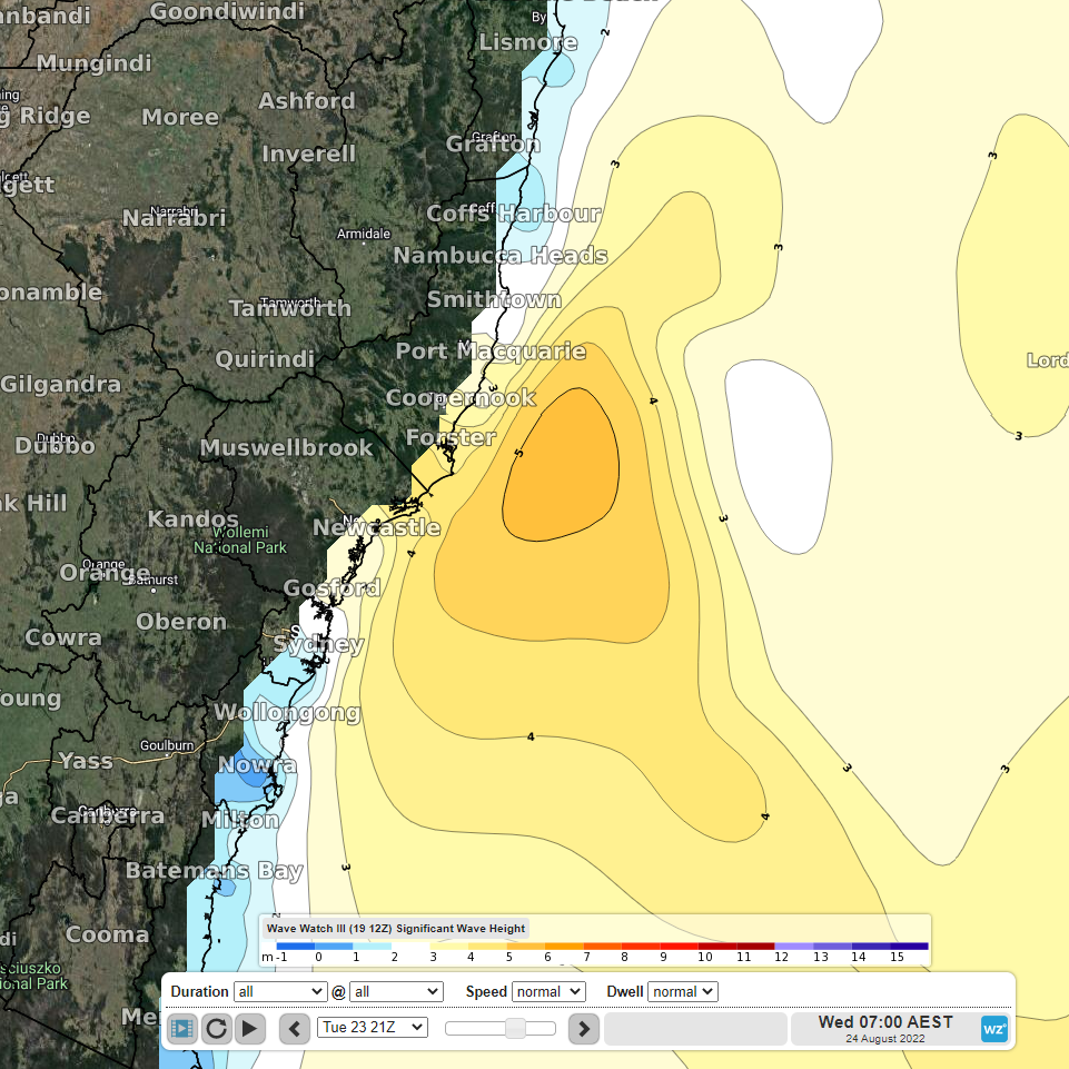
Image: Significant wave heights at 7am AEST on Wednesday 24th (Wave Watch III model)
Be sure to stay up to date with Weatherzone as this system unfolds.