Strong cold front crossing southern Australia
A strong cold front will sweep across southern Australia over the next 48 hours delivering a burst of showers, blustery winds and highland snow in several states.
The satellite images below show a large cold front crossing southwestern Australia on Wednesday morning. In the wake of the front is a large field of speckled clouds that reveals a huge cold air mass being dragged towards Australia from the Southern Ocean.
.gif)
The cold front and trailing clouds have already brought 20 to 50 mm of rain to a broad area of southwestern WA during the 24 hours to 9am on Wednesday, including 51 mm at Bickley, 39 mm at Dwellingup, and 22 mm in Perth.
A few exposed areas of southwestern WA also clocked damaging wind gusts on Wednesday morning, with gusts reaching 95 km/h at Rottnest Island shortly before 10am AWST and 106 km/k at Cape Leeuwin and Cape Naturaliste earlier in the morning.
Looking ahead, the front will continue to move towards the east over the next two days, crossing SA on Wednesday night into Thursday morning, before passing over southeastern Australia on Thursday and Friday.
One of the main weather threats associated with this front over the next 24 to 48 hours will be powerful and potentially damaging winds.
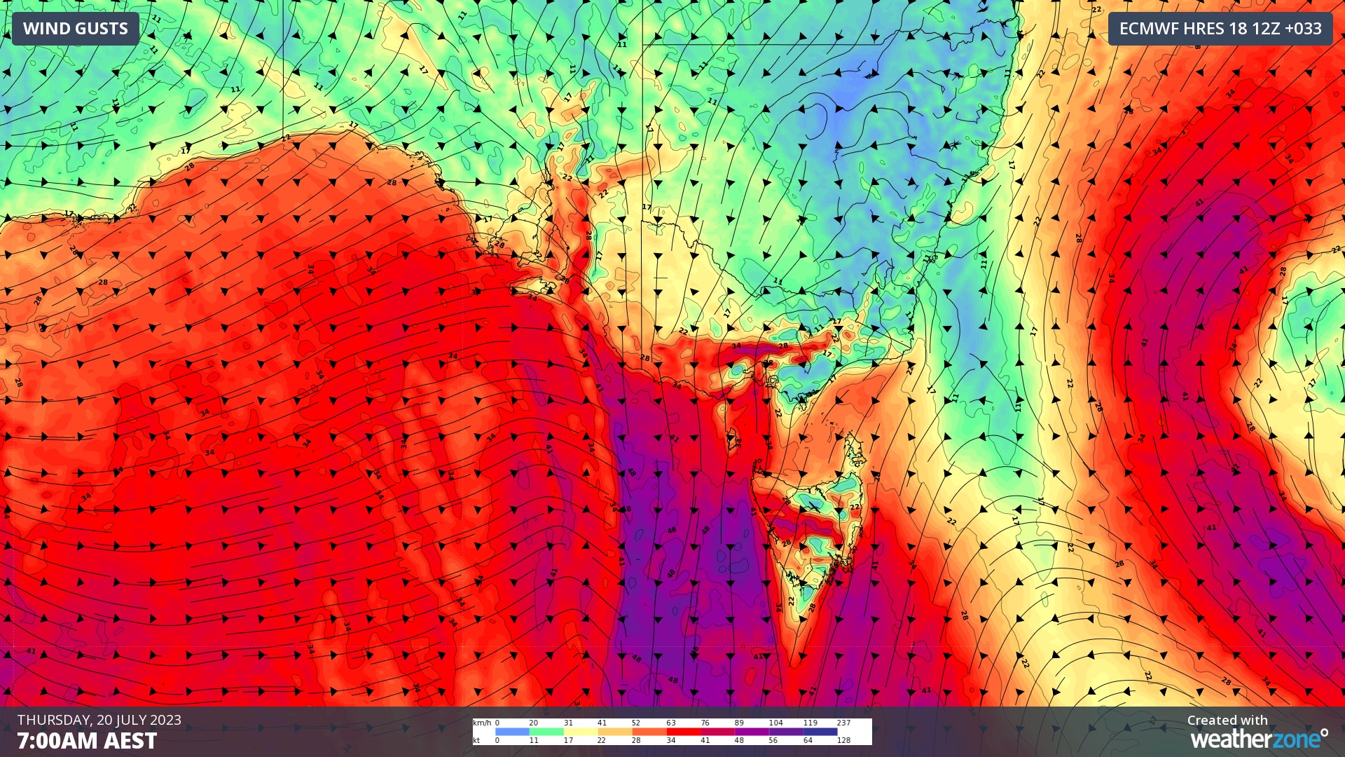
Northwesterly winds will strengthen today and tomorrow ahead of the approaching cold front, before a brisk west to southwesterly change moves through with the front itself. Severe weather warnings for damaging gusts have already been issued in parts of central Vic and inland Tasmania for Thursday.

Image: Forecast wind gusts (speed and direction) on Thursday morning, according to the ECMWF-HRES model.
The fast-moving nature of this front should prevent heavy rain in most areas, although showers will spread over parts of WA, Vic, Tas, NSW and the ACT between now and Friday. This will include some fresh snow in Tasmania on Thursday night and Friday morning, and a light dusting on the mainland Alps.
Be sure to check the latest severe weather warnings and forecasts over the next couple of days to keep up to date with this system.