
Stormy day for WA – Wild West Wednesday is on the way
Saddle up, westies! You’re in for a wild ride!
An unstable trough is beginning to develop over northern WA, which will deliver the usual garden variety springtime storms to the region over the next couple of days. But a deepening low in the Southern Ocean will begin to make its way northeast towards WA on Tuesday, October 1.
That’s when things start to get a little rough.
By Wednesday morning, the low will send a cold front sailing across WA’s west coast, causing strong and gusty winds to develop. As you can see from the forecast image below, by early afternoon, wind gusts of 80-90km/h could be lashing much of the southern half of the state, possibly including Perth. For those among you who prefer to put a positive spin on things, if you listen closely enough, you may hear the wind singing about how it just blew in from the windy city, like a regular Calamity Jane, Doris Day style.
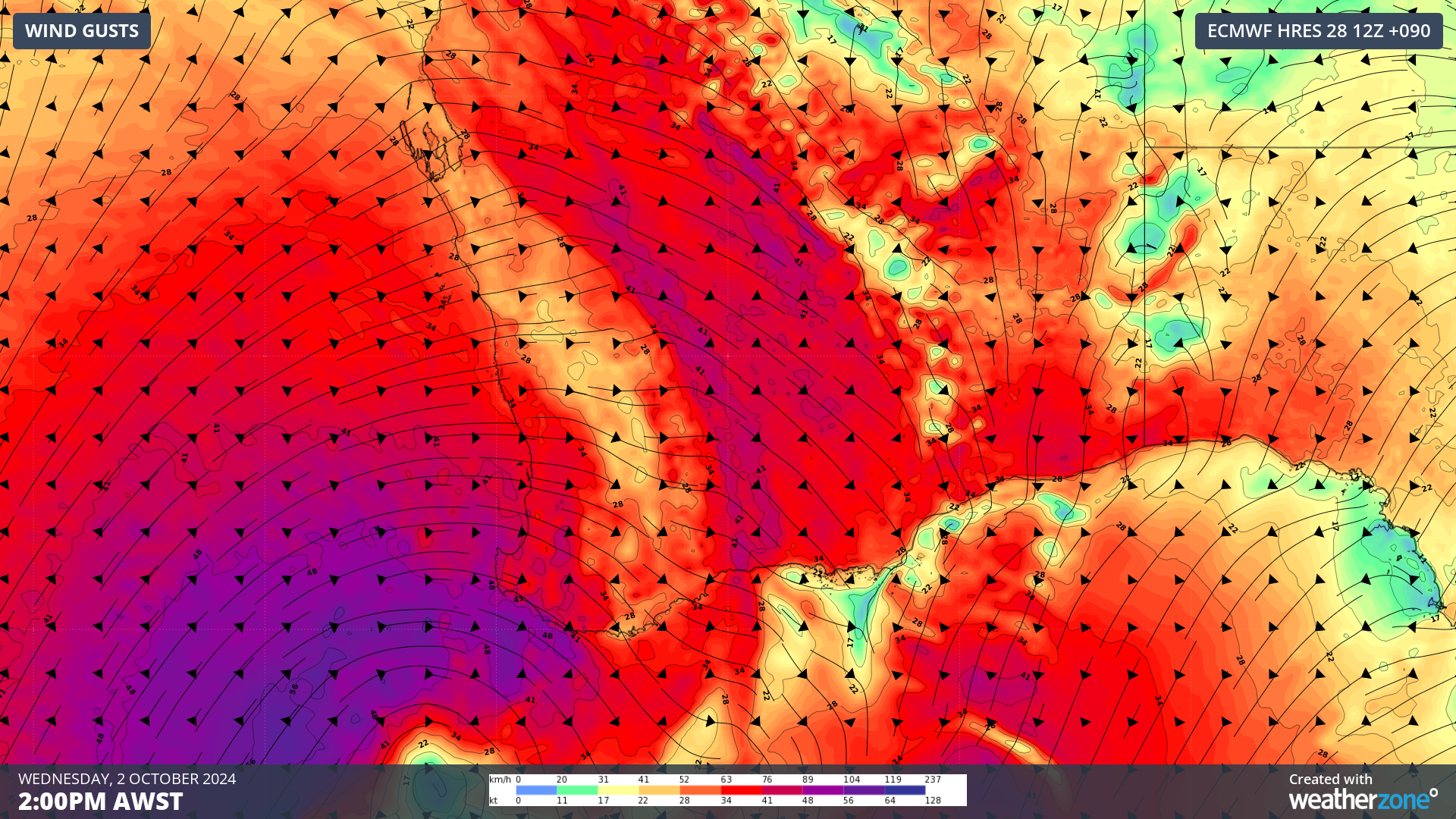 Image: ECMWF forecast 10m wind gusts over southern WA at 2pm AWST, Wednesday, October 2, 2024.
But if there’s a Calamity Jane, there must be a Wild Bill.
Well, shutter the windows and bolt the doors, dear readers, because Wild Bill will be letting off more than a few shots from his proverbial pistol on Wednesday. Just take a look at this next image.
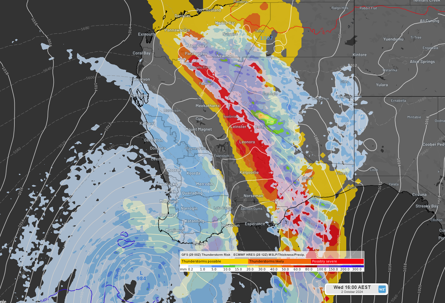 Image: ECMWF forecast 3-hourly precipitation (top layer in blue, green, yellow) and GFS Thunderstorm Risk (bottom layer in yellow, orange, red) indicating potentially severe thunderstorm activity over WA at 4pm AEST (2pm AWST), Wednesday, October 2, 2024.
Yessir, that there is some widespread thunderstorm activity on the forecast, mainly through the WA outback. These storms could generate locally destructive wind gusts of up to 130km/h, potentially affecting centres such as Esperance and Kalgoorlie. If you’re in those areas, you may want to flip a saloon table and take cover.
Looking ahead, the system is then expected to track east, with the potential to generate damaging winds along the WA coast and into southern SA on Thursday.
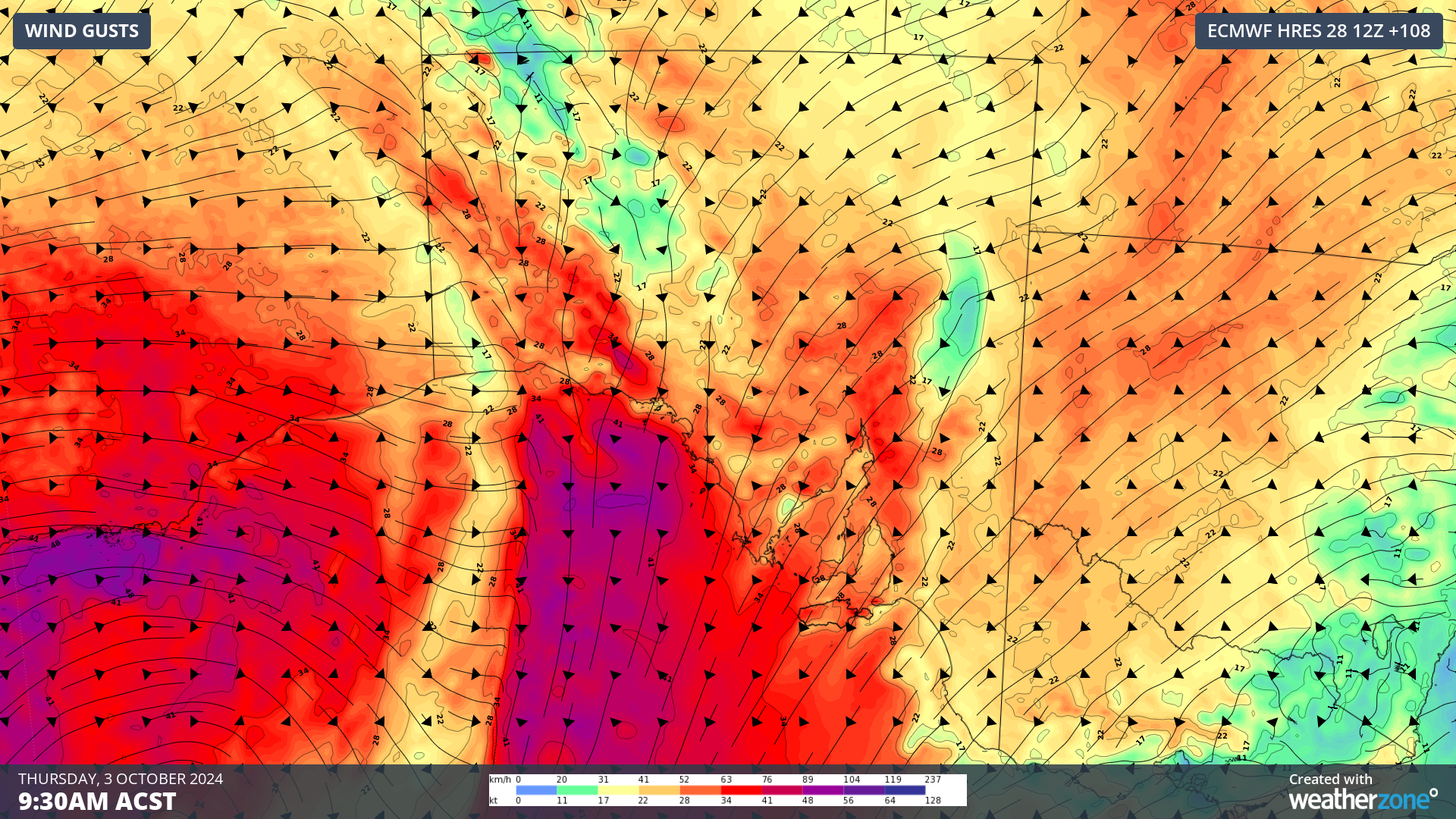 Image: ECMWF forecast 10m wind gusts showing damaging winds continuing to whip coastal WA as they approach southern SA at 9:30am ACST, Thursday, October 3, 2024.
Severe thunderstorms generating locally destructive wind gusts may also be triggered over SA on Thursday, mainly in the west of the state.
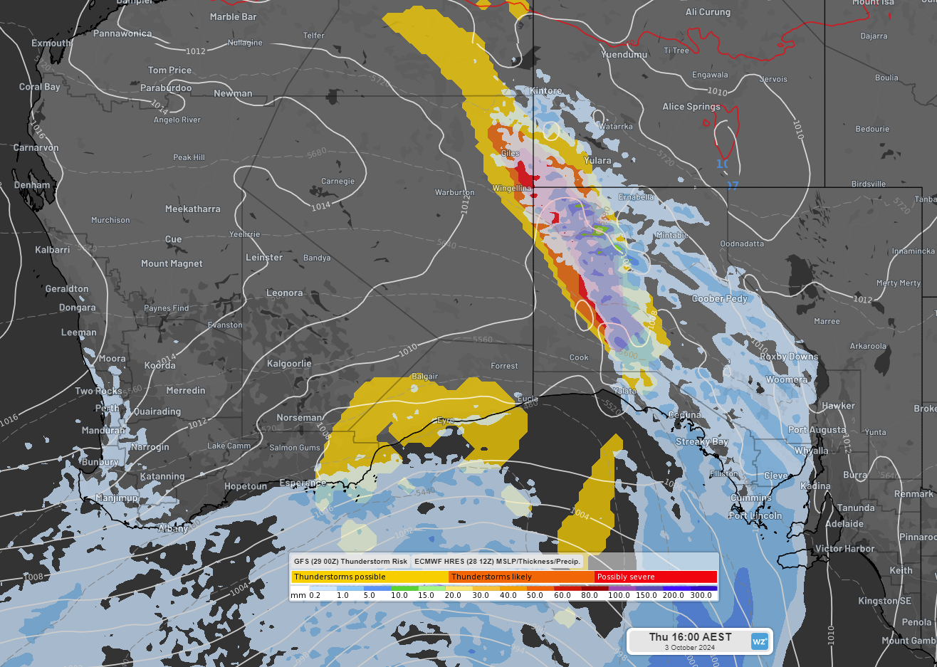 Image: ECMWF forecast 3-hourly precipitation and GFS Thunderstorm indicating potentially severe thunderstorm activity over western SA at 4pm AEST (3:30pm ACST), Thursday, October 3, 2024.
The system may then move into Vic and NSW on Friday, potentially bringing some damaging winds to Melbourne, but at this stage, it looks like the system may weaken by the time it reaches the eastern states, with only isolated non-severe thunderstorms currently expected. Be sure to keep an eye on all the latest warnings next week as the situation unfolds.