How broad is the trough?
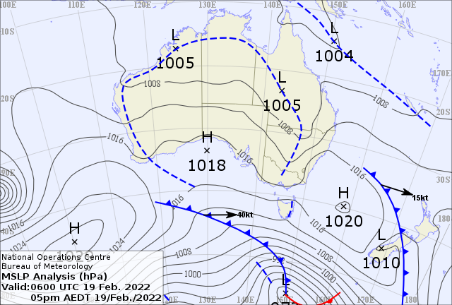
A nearly 7000 km wide trough (Fig.1) extending all the way up from western WA, across the northern tropics and into central QLD, NSW and northern VIC is once again lightning up broad areas of the country.

Figure 1. MSLP Analysis (hPa) at 5p.m. AEDT 19th Feb 2020 showing the broad trough extending over western, northern and eastern Australia.
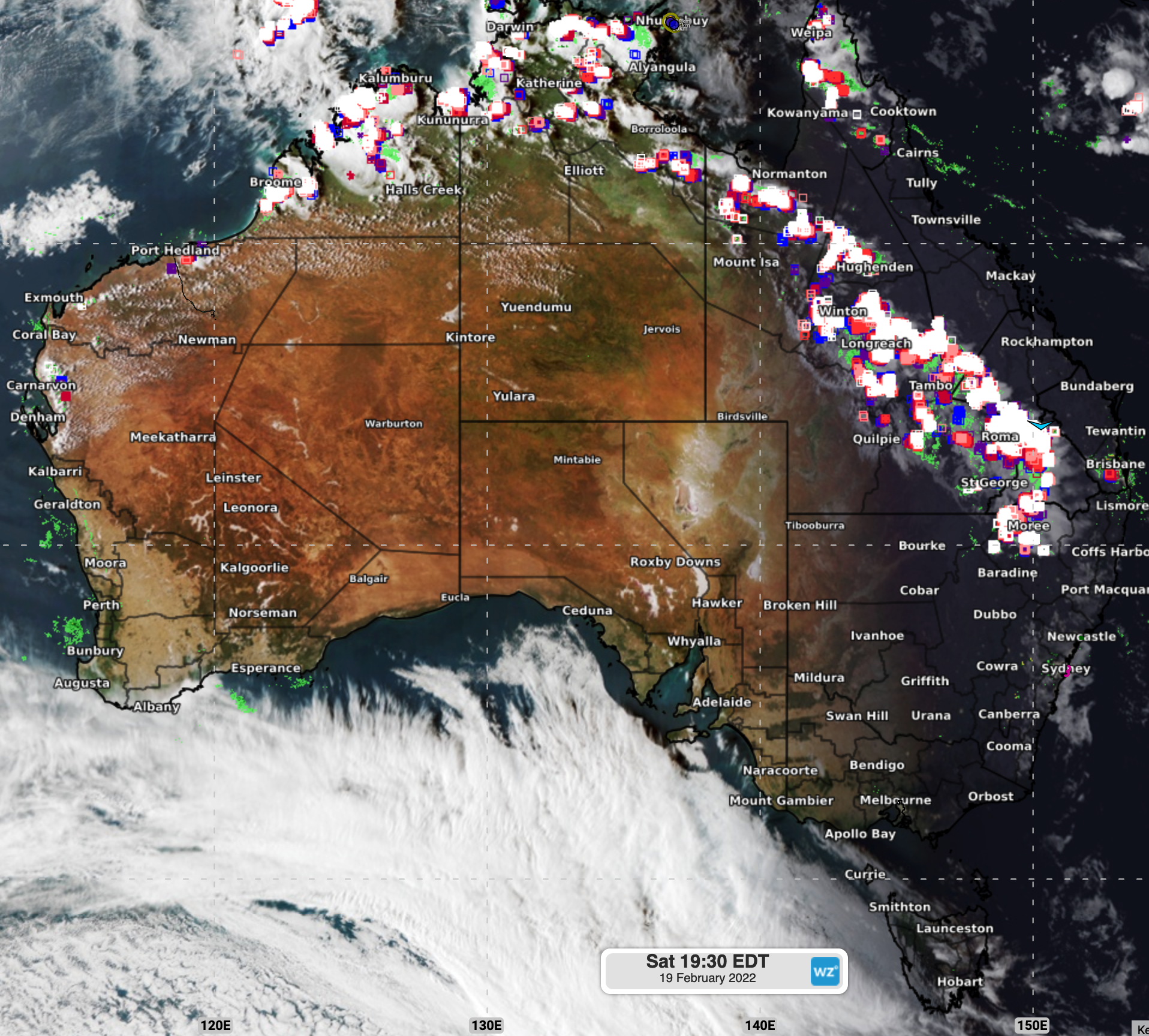
Thunderstorm and shower activity has been developing during this afternoon, mainly over northwestern, central and southeastern parts of QLD, northern NT and the Kimberley.

Figure 2. Satellite image with lightning and radar layers. 7:30p.m. AEDT 19th Feb 2020.
Some rainfall stats in the 10 minutes prior to writing this story are:
NT: Pirlangimpi (17.2mm)
NT: Jabiru Airport (19.8 mm)
NT: Elcho Island (13.8mm)
QLD: Beaudesert (10.0mm)
QLD: Coolangatta: (10.4mm)
WA: Kalumburu (7.2mm)
Wind gusts linked to thunderstorm activity have been also occurring over QLD:
Longreach aerodrome: max wind gust 81.5 km/h
Roma airport: max wind gust 74.1km/h
Cloncurry Airport: max wind gust 75.9km/h
Thunderstorms are expected to ease over the evening/night and return from tomorrow afternoon.