
Storms to intensify over eastern Australia on Thursday
A spike in atmospheric instability will cause heavy showers and dangerous thunderstorms over parts of NSW and southern Queensland on Thursday.
An upper-level trough interacting with warm, moisture-laden air will create an ideal environment for showers and storms over a broad area of eastern Australia on Thursday.
The day is likely to start out with showers over coastal districts of southeast Queensland and northeast NSW, and a few showers and thunderstorms over western NSW.
As the morning unfolds and the sun warms the ground, rising air will create more widespread showers and thunderstorms.
Storms are possible over a large swathe of eastern Australia on Thursday, stretching from southern Queensland down to southern NSW and possibly into northeast Victoria. Most of these storms will occur west of the ranges, although some could move over the ranges towards the coast in northern NSW and southeast Queensland.
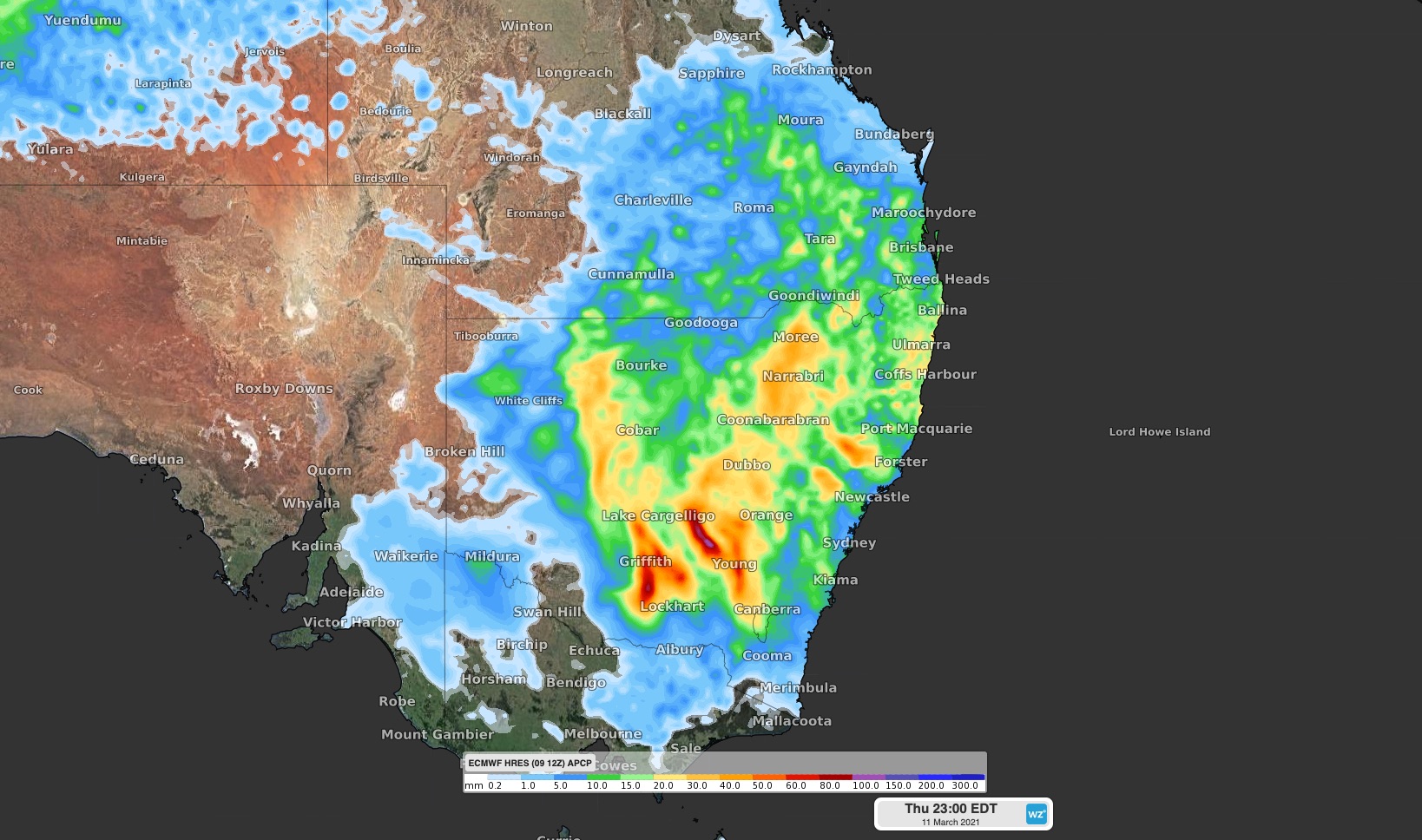
Image: Forecast accumulated rain on Thursday, March 11, according to the ECMWF model. This shows the general area that could see rain on Thursday, some of which will come from thunderstorms.
The most intense storm activity is likely to occur during the afternoon or early evening, near and shortly after the hottest part of the day.
Severe storms are possible in NSW over the western slopes and plains, northern ranges and northern inland. In Queensland, severe storms are a good chance over the southeast inland, particularly the Maranoa and Warego and Darling Downs and Granite Belt districts.
Some of Thursday's severe thunderstorms could develop into supercells, most likely over central western and northern inland NSW. Supercells are very dangerous rotating storms that are capable of producing destructive weather including giant hail and wind gusts above 125km/h.
Be sure to check the latest severe thunderstorm warnings in your area throughout Thursday.