Storms on the way for Queensland and northern NSW
Possibly severe thunderstorms are on the cards this Sunday over Queensland and northern NSW as a taste of spring hits the region.
A pair of troughs from the north and south are combining, supplying moist warm air near the surface and cold, dry air above, all the necessary ingredients for storms.
As of 10am EST, there have already been 3500 strikes between Roma and the Sunshine Coast with more storms likely in the afternoon and evening.
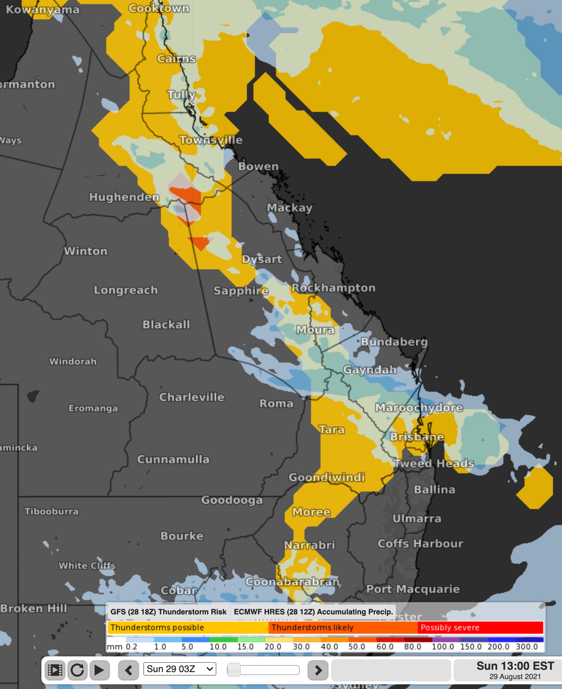
Storms are possible along the ranges between about Tamworth in northern NSW, all the way up to around Cooktown in far north Qld. Storms could also track to the entire Qld east coast, including Brisbane. However, storms are most likely in the Capricornia and Wide Bay and Burnett Regions.

Image: Thunderstorm chances and rainfall on Sunday afternoon
With the help of an upper trough, some storms may become severe, with large hail and damaging winds on the cards. To view all the latest warnings, visit here.
Storms at this time of year are a little unusual, but not that uncommon. Thunderstorm activity tends to pick up in Queensland and northern NSW in September, to be in full swing by October.
The trough from the south will head offshore on Sunday night, meaning that storms over the coming days will contract to the north. There are indications that heavy rain will start to fall around the Cairns, Townsville, and Mackay regions on Monday and Tuesday, with the possibility of 100-200mm falling in some areas.