
Soggy week ahead for parts of QLD
A moisture laden trough will linger across northern and eastern Queensland through the week to come, resulting in large rainfall accumulations.
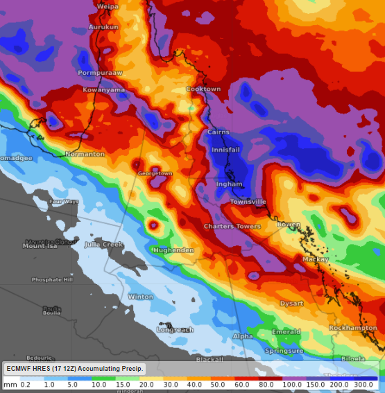
Image: forecast rainfall during the week to come according to ECMWF
Most models display the highest forecast weekly rainfall totals in the Herbert and Lower Burdekin and North Tropical Coast and Tablelands districts.
These two districts could collect in excess of 150mm by the end of the week, most likely over coastal and adjacent inland areas between Ayr and Cooktown.
Rainfall will become more widespread from Wednesday, as the trough deepens and shifts further south and west.
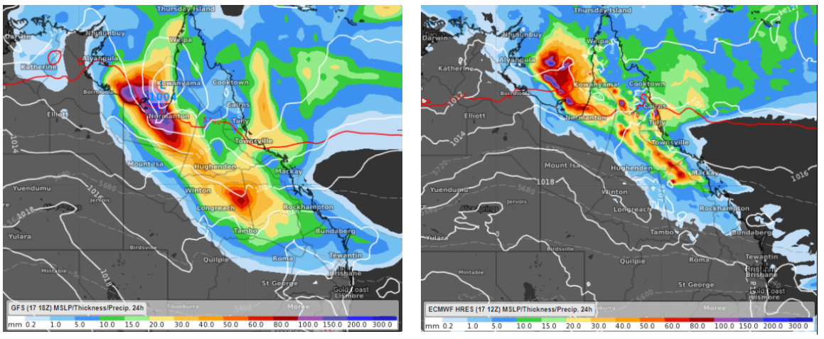
Image: Forecast 24 hours rainfall accumulation to 10pm AEST Friday according to GFS (left) and ECMWF (right), with a potential tropical low strengthening in the Gulf of Carpentaira according to GFS.
There is some uncertainty regarding heavy rainfall developing further inland on Thursday and Friday, as a potential tropical low in the Gulf of Carpentaria migrates southeast into Queensland's interior.
Flooding may occur in some river catchments during the week to come, with localised flash flooding also a distinct possibility.