Snow on the horizon as strong front approaches

Parts of central NSW could see their first snow of the year as a strong cold front barrels over southeastern Australia later this week.
A pair of cold fronts will cross southeastern Australia between Tuesday and Saturday, each bringing a burst of showers, storms, chilly wind and snow.
The first, weaker front will cross South Australia, Victoria, Tasmania and southern NSW on Tuesday and Wednesday. This system will bring about 5-15mm of rain to some areas, with the heaviest falls occurring along exposed coastal areas and about the ranges. The air behind this front will be cold enough for a few centimetres of snow on the mainland alps during Wednesday.

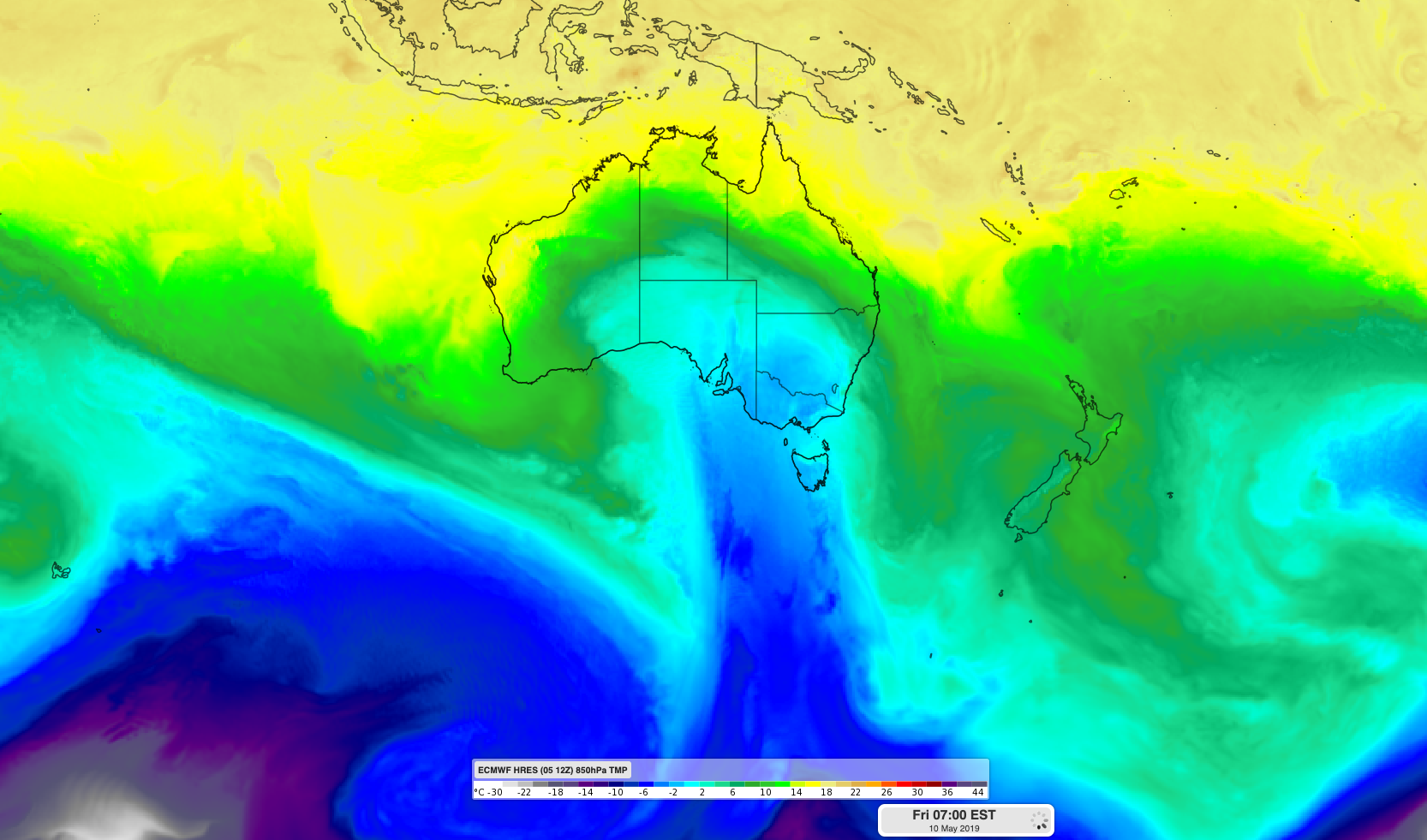
Image: ECMWF-HRES model showing cold air sweeping across southeastern Australia on Friday.
The second front will be much stronger and will spread a large pool of cold air across southeastern Australia between Thursday and Saturday. This front and the cold air in its wake will produce a wintry mix of showers, blustery winds, storms, small hail and snow in multiple states. Damaging winds gusts are likely in some areas with the passage of this system.
While there is still potential for forecasts to change during the coming days, there's a good chance that parts of central NSW will see their first snow of the season on Friday. Further south, the alps are likely to turn white as 10-20cm of fresh snow blankets some of Australia's ski resorts on Thursday night and Friday.
Drier and calmer weather will return to most of southeastern Australia on the weekend as the front moves out into the Tasman Sea.
Snow at this time of year usually melts quickly because the underlying ground is still relatively warm. Snow usually starts to accumulate more steadily in the alps from June.