Severe thunderstorms to hit NSW, Qld on Thursday
Thunderstorms will develop over a broad area of NSW and Qld on Thursday afternoon, with severe storms likely in some areas.
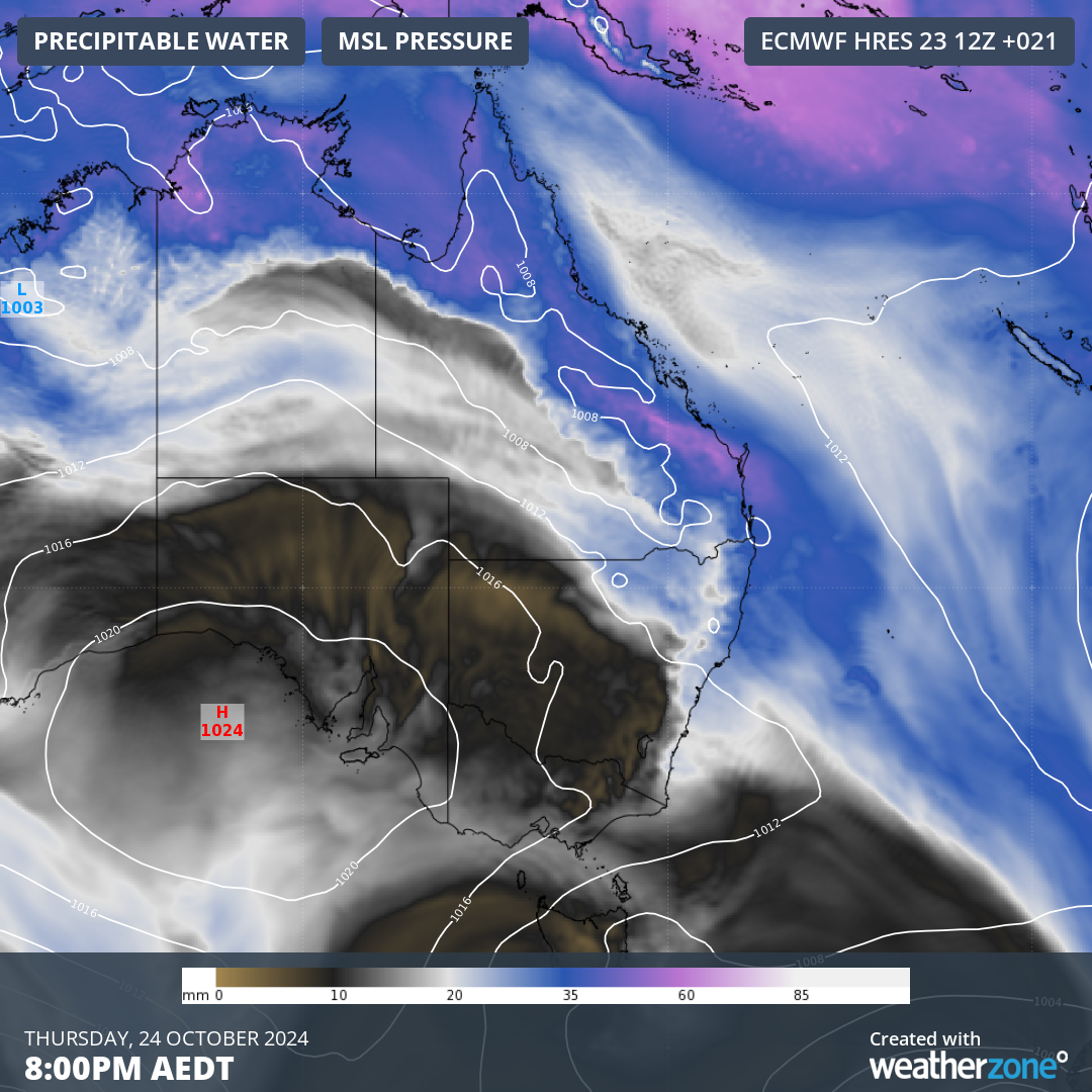
Thursday’s storms will be triggered by a low pressure trough interacting with an unstable atmosphere and moisture over eastern Australia. An upper-level trough above eastern Australia will also enhance wind shear in some areas, which is the change in wind speed and direction with height. These ingredients will produce copious lightning and elevate the risk of damaging winds and large hail for some areas.

Image: Forecast precipitable water and mean sea level pressure over eastern Australia on Thursday evening, showing a low pressure trough interacting with abundant atmospheric moisture.
In NSW, thunderstorms are most likely to occur from the Hunter up to the Northern Rivers and inland to the North West Slopes and Plains. While severe storms are possible throughout northeast NSW on Thursday, they are most likely near the coast and ranges to the north of Port Macquarie.
In Qld, thunderstorms are likely to develop over the central and southeast inland during Thursday, extending from the Wide Bay and Burnett district up through the Central Highlands and Coalfields district and surrounding areas. Rain and a few storms will then spread towards the coast into the evening.
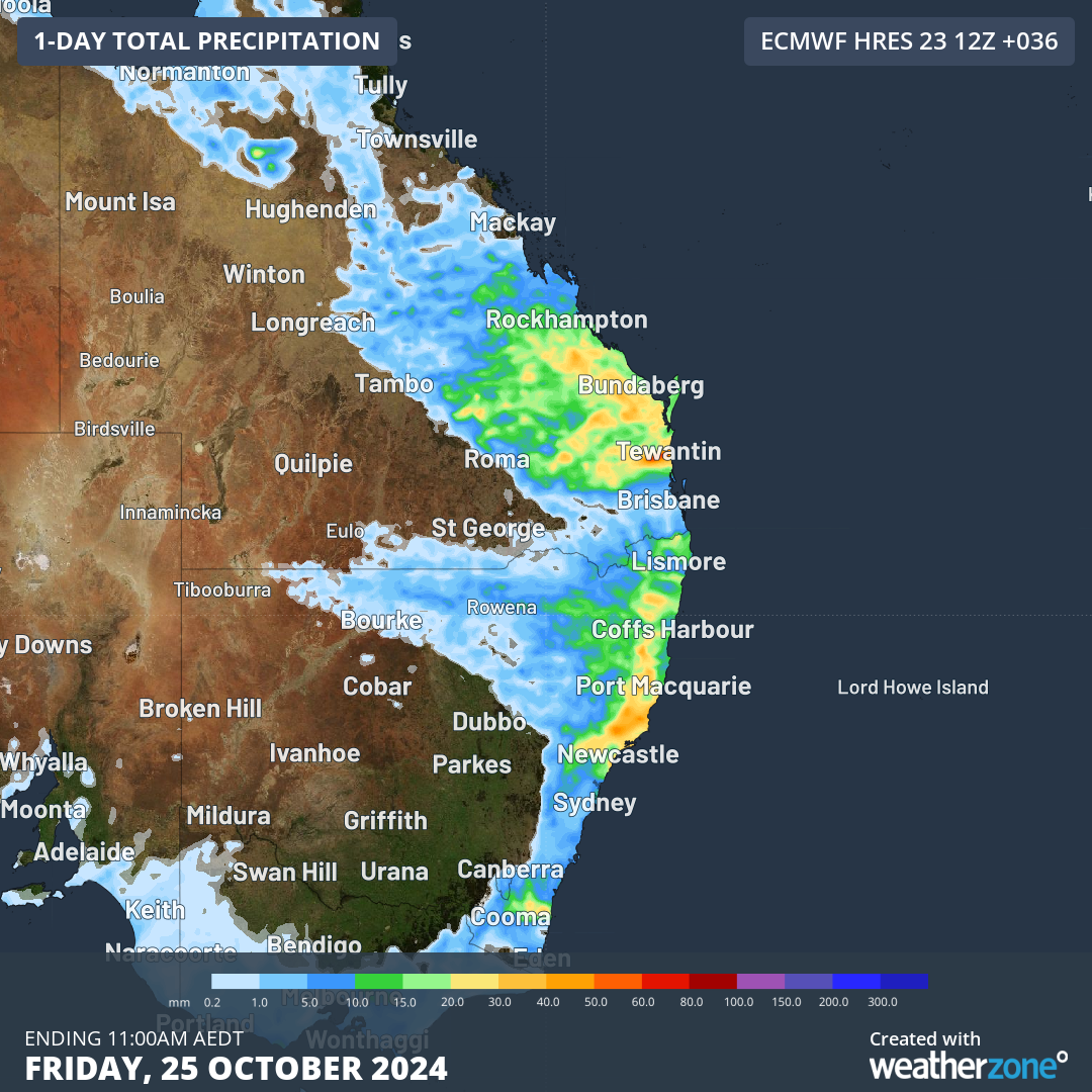
The map below shows the forecast accumulated rainfall for the 36 hours ending at 11am AEDT on Friday, giving an indication of where the rain and storms will occur on Thursday afternoon and night.

Image: Forecast accumulated rain during the 36 hours ending at 11am AEDT on Friday, October 25, according to the ECMWF model.
Any thunderstorms that develop over eastern Australia will be dangerous because they produce lightning. However, thunderstorms are only considered severe in Australia when they produce at least one of the following:
- large hail – 2 cm in diameter or larger
- damaging wind gusts – 90 km/h or greater
- tornadoes
- heavy rainfall that may lead to flash flooding
A severe thunderstorm warning will be issued if an active thunderstorm is expected to produce any of the above phenomena. Be sure to check the latest warnings throughout the afternoon for the most up-to-date information.