Sea fog shrouds Bondi Beach

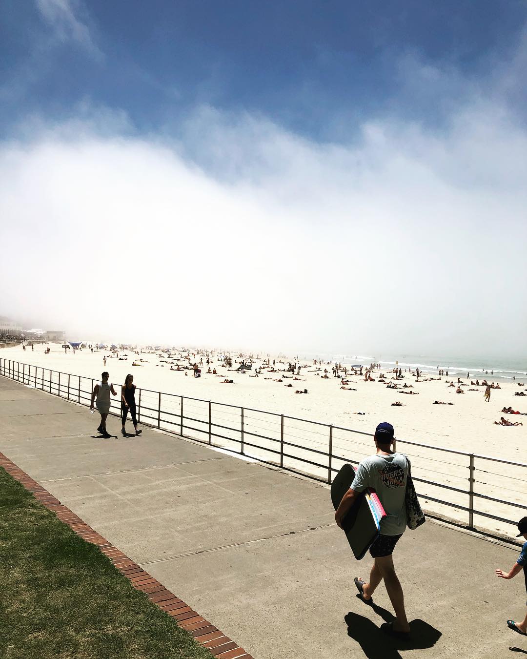
Thick fog blanketed parts of Bondi Beach today, briefly shielding beachgoers from the midday summer sun.
Bondi is a popular place to be today, with temperatures pushing above 30 degrees in the city and over 32 degrees at Richmond before 1pm. However, those lucky enough to escape the heat at the beach were also treated to a unique meteorological phenomenon, as sea fog drifted across the sand.
The thick layer of sea fog made its way up the central coast of NSW during the morning before passing over Bondi Beach in the middle of the day.

Image: Bondi Beach today. Source: Blaze Hackman
The fog occurred as warm and moisture-laden air passed over cooler water, ahead of an approaching weak southerly change.

Image: Bondi Beach today. Source: George Elias
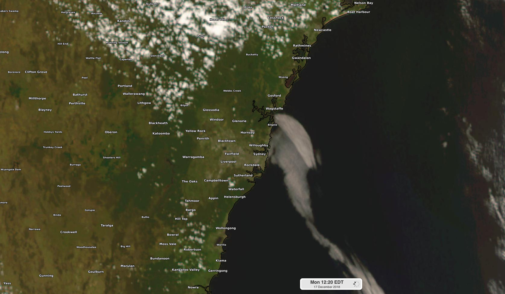
A tongue of humid air ahead of the change was cooled by the water it was travelling over. As the air cooled to a temperature known as its dew point, the fog started forming.

Image: Visible satellite image showing the sea fog, which formed along a weak southerly change.
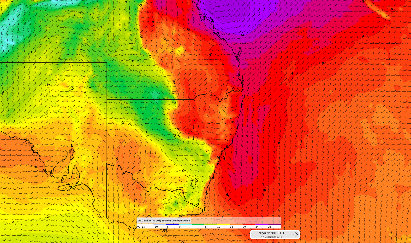
The dew point temperature of air is the temperature it needs to cool down to for cloud droplets to start forming through condensation. Both the air and water near Sydney today had just the right ingredients to cause the fog to form.

Image: Forecast dewpoint temperatures showing moisture-laden air being transported towards the south near eastern NSW
Sea fog is not unheard of at this time of year in NSW, because the air is frequently warmer than the underlying oceans. This occurs because the oceans take longer to warm up during summertime than the air does. The key ingredient today was abundant moisture in the air, which is being carried towards central NSW by northerly winds over the Tasman Sea. This moisture also helped fuel violent thunderstorms in Sydney on the weekend.
The warmest water temperatures occur near Sydney in late summer and early autumn, while the warmest daytime air temperatures are during January, on average.