
Rain on tap across southern Australia in the week ahead
The tap is being turned on this weekend and through next week as cold fronts run across the south of the country, bringing much needed rainfall to parts of the country that have been parched.
The 4 month rainfall deficiencies from the start of February to the end of May paint a bleak picture for parts of WA, SA, Victoria and Tasmania.
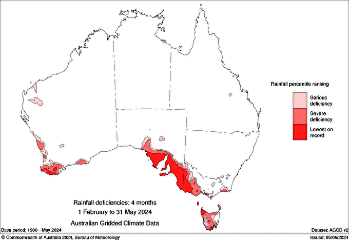
Image: 4 month rainfall deficiencies from 1 Feb to 31 May 2024. Source: BOM
This has led to the root-zone soil moisture (1m depth) being very much below average for those regions.
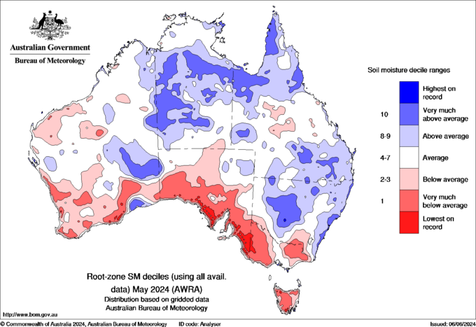
Image: root-zone soil moisture deciles for May 2024. Source: BOM
Considering this, the rain with these fronts will be a welcome sight. The first front reached WA’s southwest early Saturday morning with some towns including Bunbury recording more than 20mm. This front will reach SA later tomorrow and then Victoria and Tasmania late on Monday.
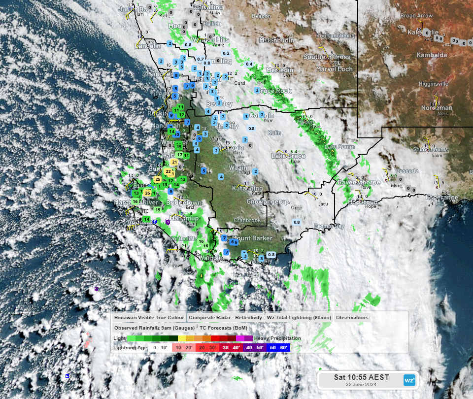
Image: Himawari-9 visible imagery, BOM radar and rainfall measurements (mm) at 8:50 WST Saturday 22.
The next front is currently brewing in the Southern Ocean about 3000km to the southwest of WA and will arrive on Wednesday, ushering in a second round of showers, isolated thunderstorms and gusty winds for parts of WA until next Saturday, SA on Friday and Saturday, and Victoria and Tasmania on Saturday and Sunday.
All up these systems are set to deliver widespread falls of 5-15mm during the next 7 days with several regions looking at 20-60mm, heaviest for coastal and mountainous regions.
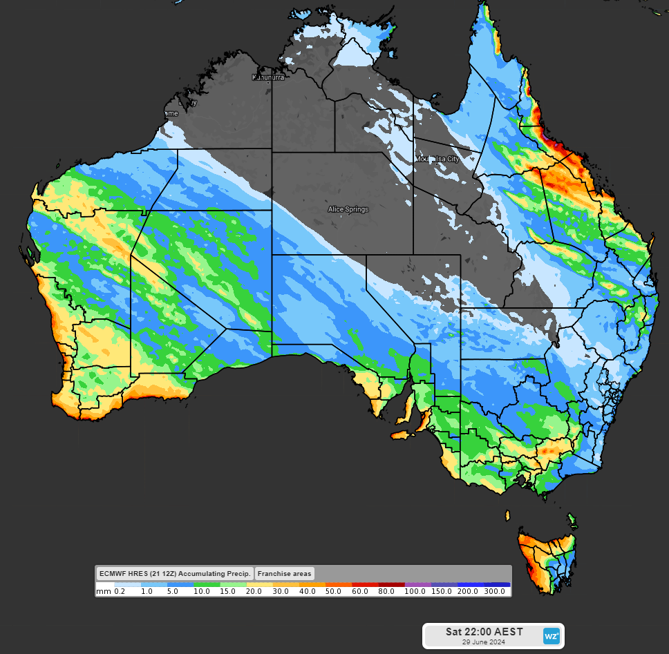
Image: Accumulating rainfall to 10pm AEST Saturday 29 June according to the high-resolution ECMWF model.
To see what might be in store for July please check out Weatherzone's climate outlook.