
Queensland's soggy week comes to an end
Queenslanders will be enjoying some relief from the severe weather that occurred across the state in recent days.
Southerly winds from a high pressure system caused warm, dry air over South Australia to be pushed north, interacting with a moist trough stretching across the interior of the country. As this high pressure system moved eastward, it pushed the trough northeast over Queensland, delivering intense storms to the state as it passed over.
Those storms delivered some impressive rainfall totals to eastern parts of the state between Wednesday 2nd and Friday 4th of February. In the 24 hours to 9am on Thursday morning, Castle Creek and Theodore near Biloela had received 151 mm and 145 mm of rain respectively (almost twice their monthly average rainfall), Mundubbera near Gayndah had received 130 mm, and Cooroy near Tewantin had received 110 mm.
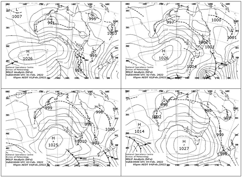
Image: a series of synoptic charts from 1-4 February at 5pm each day, showing the passage of the trough that brought wild weather to Queensland. Source: Australian Government Bureau of Meteorology
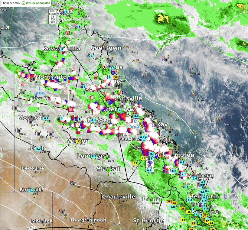
Image: Radar and lightning tracker data over Queensland at 4:44pm on Thursday 3 February
The rain didn’t stop there. In the 24 hours to 9am yesterday morning Blenheim near Gatton had received 137mm of rain, Gowrie and Ravenswood near Toowoomba had each received 125mm and 102mm respectively, and Beachmere near Redcliffe had received 102mm of rain.
Impressive rainfall totals also occurred in the state’s north as the trough marched northeastward, with Strathmore receiving a whopping 270mm of rainfall in the 24 hours to 9am yesterday morning, a figure roughly twice the site’s average monthly rainfall. Weather stations around the Innisfail region recorded 95-160mm of rain in the 24 hours to 9am this morning, but rainfall since then has eased significantly, recording only around 20mm so far.
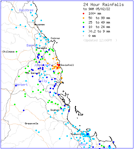
Image: 24 hour rainfall totals to 9am Saturday 5 February around the North Tropical Coast region, showing heavy rain over the Innisfail area. Source: Australian Government Bureau of Meteorology
While the far north can expect a few more showers and storms with a trough lingering over the tropics, most of the state is now dry under the influence of a high-pressure ridge, with only the odd shower popping up along the southeast coast. Conditions are expected to stay that way for a few more days, although the state’s west could begin to see rain creeping into the region on Monday morning.