
Historically low early September snow depth as more resorts announce closure
The snow depth at Spencers Creek in the Snowy Mountains of New South Wales has dipped to 31.2 centimetres this Thursday, September 3 – the lowest on record for this time of year as more ski resorts announce early closures.
Hydro-electric operator Snowy Hydro has regularly measured snow depths since 1954 at three NSW locations, the highest being Spencers Creek at an elevation of 1830m, which is close to the ski resorts of Perisher, Thredbo and Charlotte Pass.
This year's peak depth was 94.5 cm on August 13, which was the third-lowest on record. But the 2026 season looks likely to be the shortest on record in terms of the duration of a measurable snowpack.
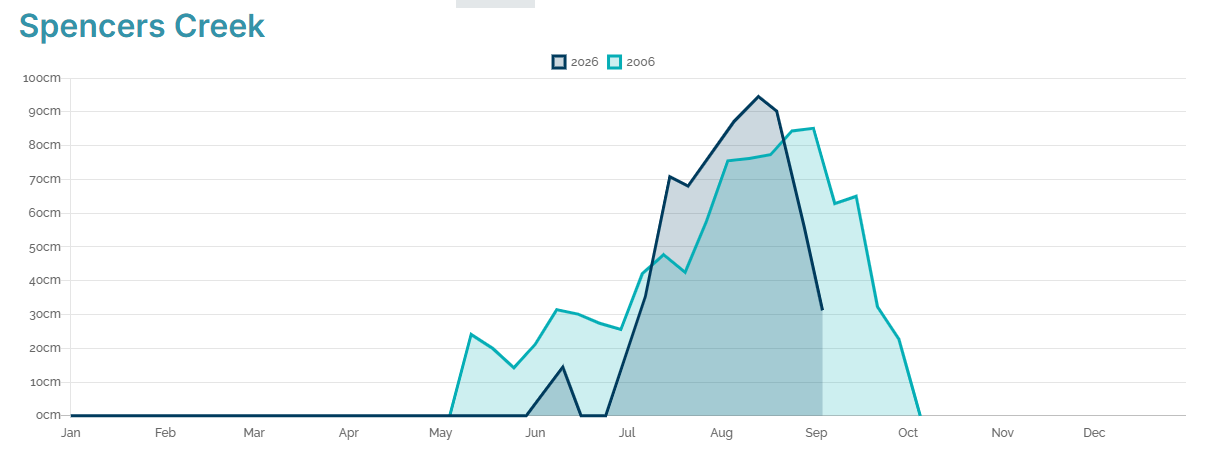
Image: Comparison of the graphs at Spencers Creek, NSW for the 2006 seas`on (the lowest peak depth on record, in light blue) and the 2006 season (possibly the shortest season with measurable snow on record, dark blue). Source: Snowy Hydro.
- Historically, the peak season depth has typically occurred around the first week of September.
- In the 1950s, '60s and '70s, the average depth in the first week of September was more than 180 centimetres.
- Thus far in the 2020s (but not including this year) the average depth in the first week of September has been around 120 centimetres.
- This year's 31.2 cm, as measured on September 3, is the lowest on record for the first week of September.
Which ski resorts have closed and which are still open?
Already, two of Australia's eight mainland ski resorts have ceased lift operations for the season, with Victoria's Mt Baw Baw and Selwyn Snow Resort in NSW both not making it through to the last week of winter.
This week, Victoria's Mt Hotham and Falls Creek both announced that the last remaining ski lifts would close this Sunday, September 6 – still four weeks ahead of the planned season closing on October 4. Charlotte Pass in NSW also said it would close this weekend, with the lifts closing on Saturday, September 5.
Perisher in NSW remains open this Thursday with 11 of its 45 lifts spinning – all of them in Perisher itself with the normally interlinked areas of Blue Cow, Guthega and Smiggin Holes all closed.
Thredbo also remains open, while Mt Buller in Victoria is down to two beginner lifts with no word yet on the final day of lift operations.
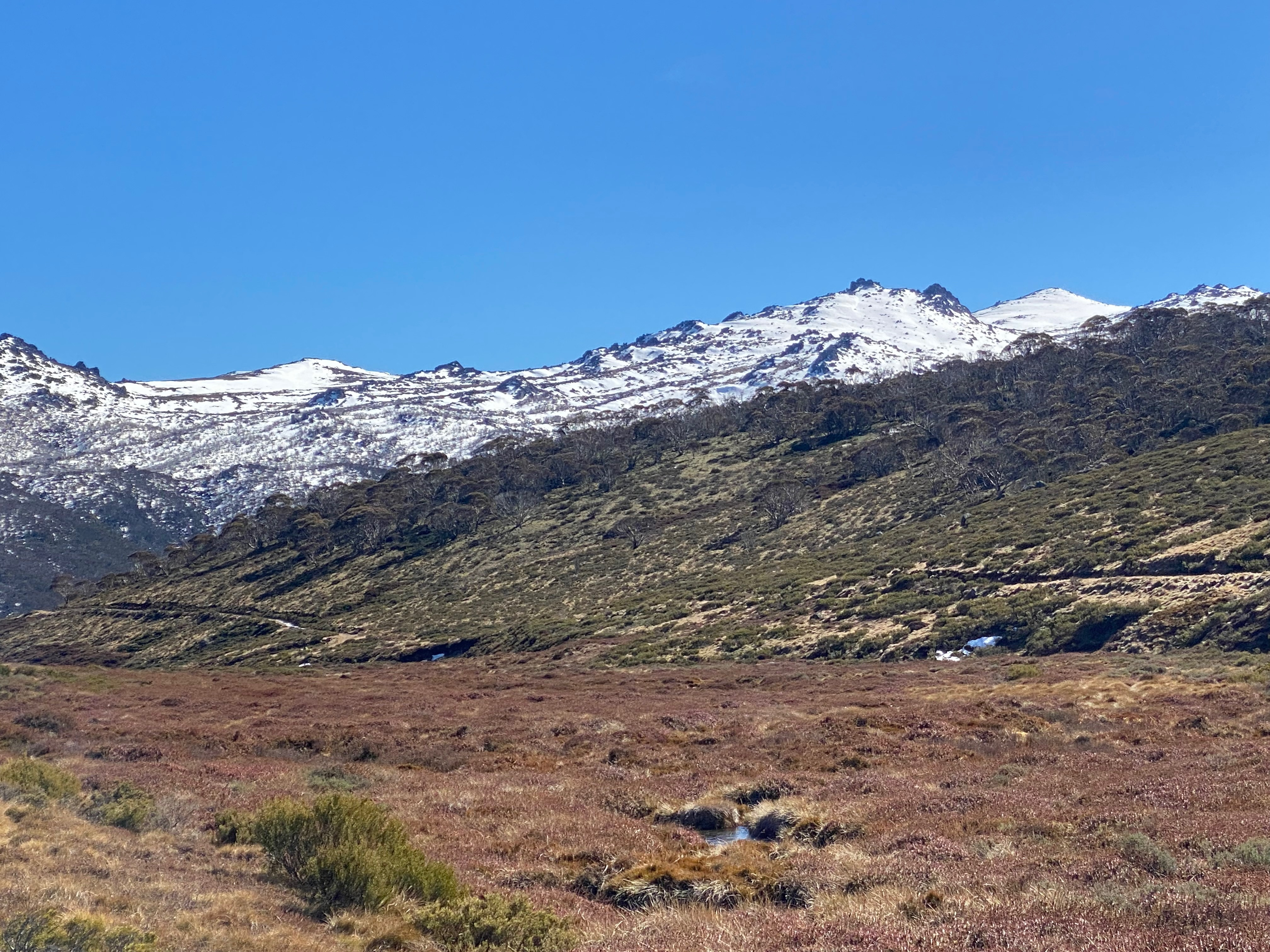
Image: An August view of the Ramshead Range near Thredbo from a snowless valley which would normally be at least partially snow-covered in an average winter. Source: Weatherzone.
Why has this been such a mediocre snow season?
In essence, it comes down to unseasonable warmth throughout much of winter, as well as a lack of snow-bearing cold fronts.
The slightly longer version was outlined in our story on September 1 about the 2026 winter being the warmest on record across large parts of Australia – including in Tasmania, Victoria and NSW/ACT, the only Australian states or territories where snow falls regularly in winter.
In that story, we identified five main reasons for the winter warmth, all of which directly impacted this year's meagre snow depth. In summary:
El Niño
El Niño typically brings drier than average winters and warmer maximum temperatures (due to lack of cloud) to eastern Australia and some other parts of the country.
Lack of cold air with frontal systems
While relatively brief bursts of cold weather did occur, prolonged cold spells were absent, with most cold fronts being pushed southwards by persistent blocking high pressure systems.
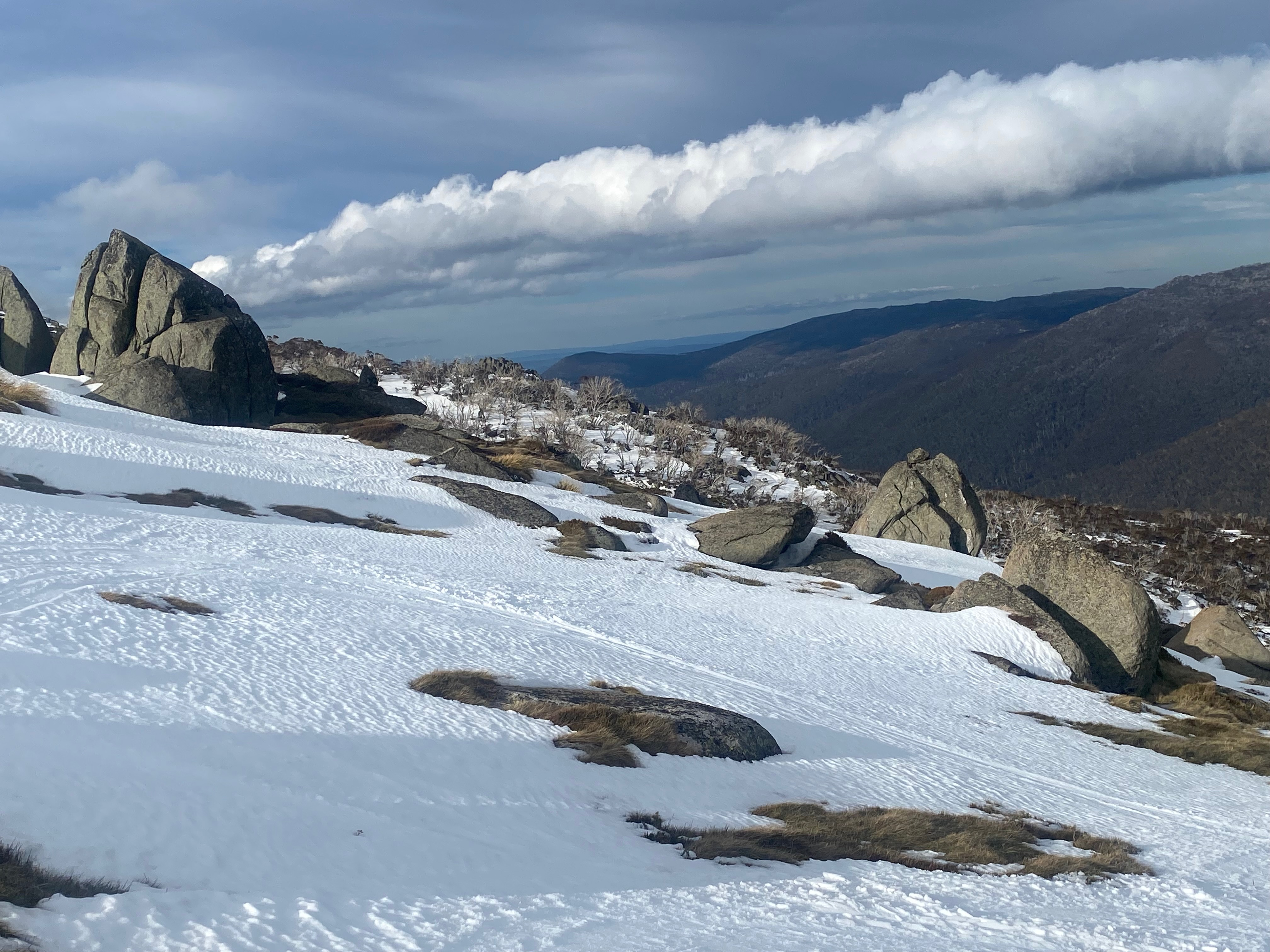
Image: A moody sky and patchy snow even at the top of Thredbo in the last week of winter, 2026, Source: Weatherzone.
The positive Southern Annular Mode (SAM) in June
The SAM is a climate driver which influences the north-south displacement of the belt of powerful winds which flow year-round from west to east over the Southern Ocean, relative to where it would normally be positioned at a given time of year.
The strongly positive SAM in June meant that that the belt of westerlies was further south than usual. An early snowfall just in time for the official snow season opening on June 6 provided a flicker of hope, but by July 1, the mainland high country was snowless for just the second time on record.
Above average sea surface temperatures around Australia
Sea surface temperatures in almost all Australian waters were warmer than average during winter.
When air passes over warmer-than-average water, it absorbs some of the heat, which means slightly warmer temperatures as the air moved inland. This helped fuel several rain events over the mountains at a time of year when you'd ordinarily expect snowfalls.
The underlying influence of climate change
The ongoing trend of atmospheric and oceanic warming across the world helped turn what might have been a mediocre snow season by historical standards into one of the worst on record.
Despite the moderate conditions, snowmaking helped keep slopes open through most of June, July and August and even into Setpember at most resorts. Mountain operations crews also spent countless hours moving snow onto high-traffic areas to keep key runs open.
Please check the Weatherzone snow page for the latest forecasts, live cams and much more during what remains of the 2026 Australian snow season.