Close to a metre of rain in southeast QLD
More than 800mm of rain has inundated parts of southeast Queensland during the last four days, with more severe weather on the way.
A persistent and deep stream of moisture-laden winds feeding into an upper-level pool of cold air has produced days of heavy rain in parts of southeast Queensland and northeast NSW.
While hundreds of millimetres has fallen over a broad area of the coast and adjacent inland, the highest accumulated totals between Friday and Monday occurred on the ranges near the state border.
A rain gauge at Upper Springbrook received 738mm of rain during the 72 hours to 9am on Monday. Other notable totals during the same period included 470mm at Currumbin Creek in Queensland and 401mm at Bald Mountain in NSW.
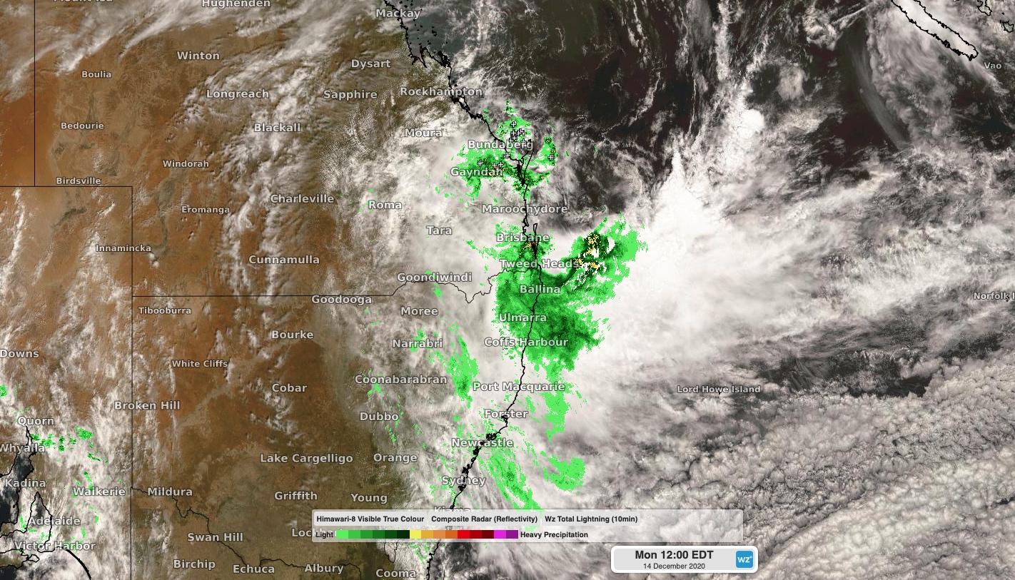
On Monday, heavy rain continued to soak parts of southern Queensland and northern NSW as a complex low pressure system drifted ashore. A gauge in the Fairlies Knob National Park to the west of Fraser Island picked up 155mm between 9am and 1pm AEST. Meanwhile, Upper Springbrook added another 69mm during these four hours, pushing its running four-day total up to 807mm.

Image: A complex low pressure system bringing heavy rain to Australia's east coast on Monday.
In addition to the heavy rain, the persistent stream of strong to gale force onshore winds has also whipped up large and dangerous surf. These powerful waves have combined with high tides near a full moon to cause significant coastal erosion in some areas. Byron Bay's popular Main Beach disappeared beneath the sea on Monday morning.
According to data from the Manly Hydraulics Laboratory and Queensland Government, this storm event caused the tide to be over 60cm higher than tshould have been on Monday morning.
Looking ahead, heavy rain, damaging winds, abnormally high tides and damaging surf will continue in southeast Queensland and northeast NSW into Monday afternoon and evening. The focus of this severe weather will contract into northeastern NSW on Tuesday before easing by Wednesday.
At 1pm AEST on Monday, a flood watch was in place between Queensland's Wide Bay and Burnett District and the Mid North Coast in NSW. Severe weather warnings were in effect between Fraser Island in Queensland and Coopernook in NSW. Numerous flood warnings, hazardous surf warnings and a severe thunderstorm warning were also in place.
Rain from this system will also extend down to central NSW from Tuesday, including Sydney, although it won't be as heavy as it has been further north.