Bitterly cold day by Brisbane and southern QLD standards
Brisbane tends to get its coldest winter days when it's wet with low cloud keeping temperatures down, but this Wednesday is different.
Today, the Queensland capital and pretty much the whole southern half of the state is experiencing a different type of cold - a cold that is windy and brisk but rain-free, like a dry winter day in the southern states.
How cold is it exactly?
- Well, at 9:20 am it was just 13.4°C in Brisbane, but the apparent temp was only 7.3°C. The apparent temp is a combination of the air temp plus wind speed and humidity.
- But even without the wind chill, it's chilly in Brisbane today. The forecast max is just 17°C.
- To put that in perspective, Brisbane's coldest days so far in 2021 were July 3, when the maximum was 17.8°C (and coincidentally, 17.8 mm of rain fell) and June 26, which was also wet with a top of just 17.5°C.
- Today could be the coldest day of the year, yet will likely see not a drop of rain, which is pretty amazing.
- For the record, Brisbane's coldest day on record was August 12, 1954, when the temperature peaked at just 10.2°C. Days with maximums below 17°C have occurred in May, June, July and August.
- So today's temperature is not exceptional by historical standards. But we'll say it again. To get a dry day this cold is rare. So you're well within your rights to be rubbing your hands together to keep them warm!
As mentioned, it's also an extremely cold morning beyond Brisbane and the SE corner of the state. Anywhere west of the city on the Darling Downs and beyond was struggling to top 10°C at 10:30 am.

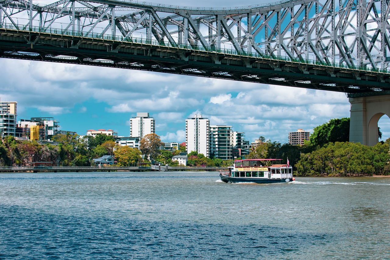
Image: You'd have to say that the Brisbane River almost has a Yarra River feel today. Source: Pixabay.
So what's causing that freezing feel?
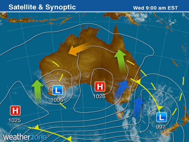
It's all because of a cold front which has pushed frigid Southern Ocean air all the way north beyond the NSW/QLD border with virtually no moisture. The 9 am synoptic chart illustrates it well.
That blue arrow over NSW shows cold air being pushed northwards and running rampant in Qld, like Tommy Turbo in Games I and II of this year's State of Origin series.

So what happens next?
Fistly, Brisbane will almost certainly see its coldest night of the year on Wednesday night into Thursday morning, with a minimum of just 5°C expected.
Widespread frost is also likely in many inland parts of Queensland, and we're pretty sure we'll have a story on that right here at Weatherzone tomorrow, as some seriously cold temps could be recorded.
But otherwise, Brisbane itself should warm up to the low twenties by the end of the week, with the chance of a few showers about on Friday.
WHERE IS WINTER IN THE NORTH? OUR STORY FROM LAST WEEKEND ABOUT UNUSUALLY MILD WINTER TEMPS IN N QLD