A window of dry across the east, then more damp

A cold front and trough has been steadily marching across the east over the last 24 hours, bringing over 100mm of rain to northern Tasmania, northeast Victoria and southeast NSW as well as 50mm to parts of southwest Queensland.
Tumbarumba, Cabramurra, Thredbo, Mt Hotham and Geehi were some of the locations to gain over 100mm, with greater than 50mm over an extensive area, including Wagga Wagga, Cooma, West Wyalong, Temora (NSW), Wangaratta (VIC), Wynyard, Devonport (TAS) and remote areas near Longreach (QLD).
This was the heaviest rain in over 3 to 4 years for most of southern NSW, northeast VIC and northern Tasmania, and the highest for the month of February in nearly 10 years. Wagga Wagga and West Wyalong were singled out, having their heaviest February rain in 40 years and 20 years, respectively.
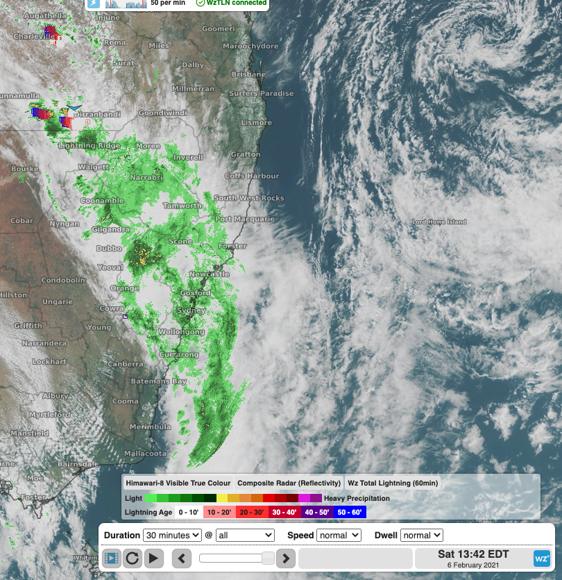
The rain is now moving over central parts of NSW, affecting a swathe of the state from the North West Plains to the Sydney area. Parts of the Central Tablelands have already picked up 30 mm since 9 am and rain will continue through the rest of Sunday. In Queensland, storms have started to fire up again in the Longreach and Charleville area and will start to extend into NSW this afternoon, enhancing rainfall in some areas, particularly about elevated areas of the Central Tablelands and Hunter. Cloud and the heaviest rain is clearing over southern NSW, eastern Victoria and Tasmania in the wake of the trough.

Image: Satellite and radar imagery showing extensive cloud and rain, as well as storms over eastern Australia on Saturday, 6th Feb, 2021.
The system is gradually weakening as it moves northeast and rainfall totals over the next 24 hours will be less than the previous 24 hours, though widespread totals over 30 mm are expected.
On Sunday, a dry westerly wind behind the trough will bring a mostly clear, sunny day to southern NSW. This will be a brief reprieve in the recent sog, with southeasterly winds to surge over the coast Sunday night and into the new week, bringing more cloudy, intermittently showery conditions like we've had a lot of recently.
The trough will weaken over Queensland on Sunday and Monday before gaining strength again mid-week as it takes on tropical moisture. Central east Queensland (Mackay to Townsville) should see some heavy rain and storms from Tuesday as the trough stalls over the region.